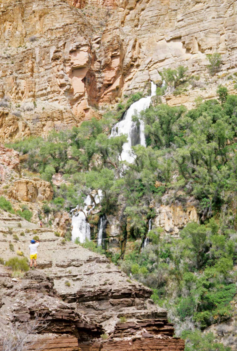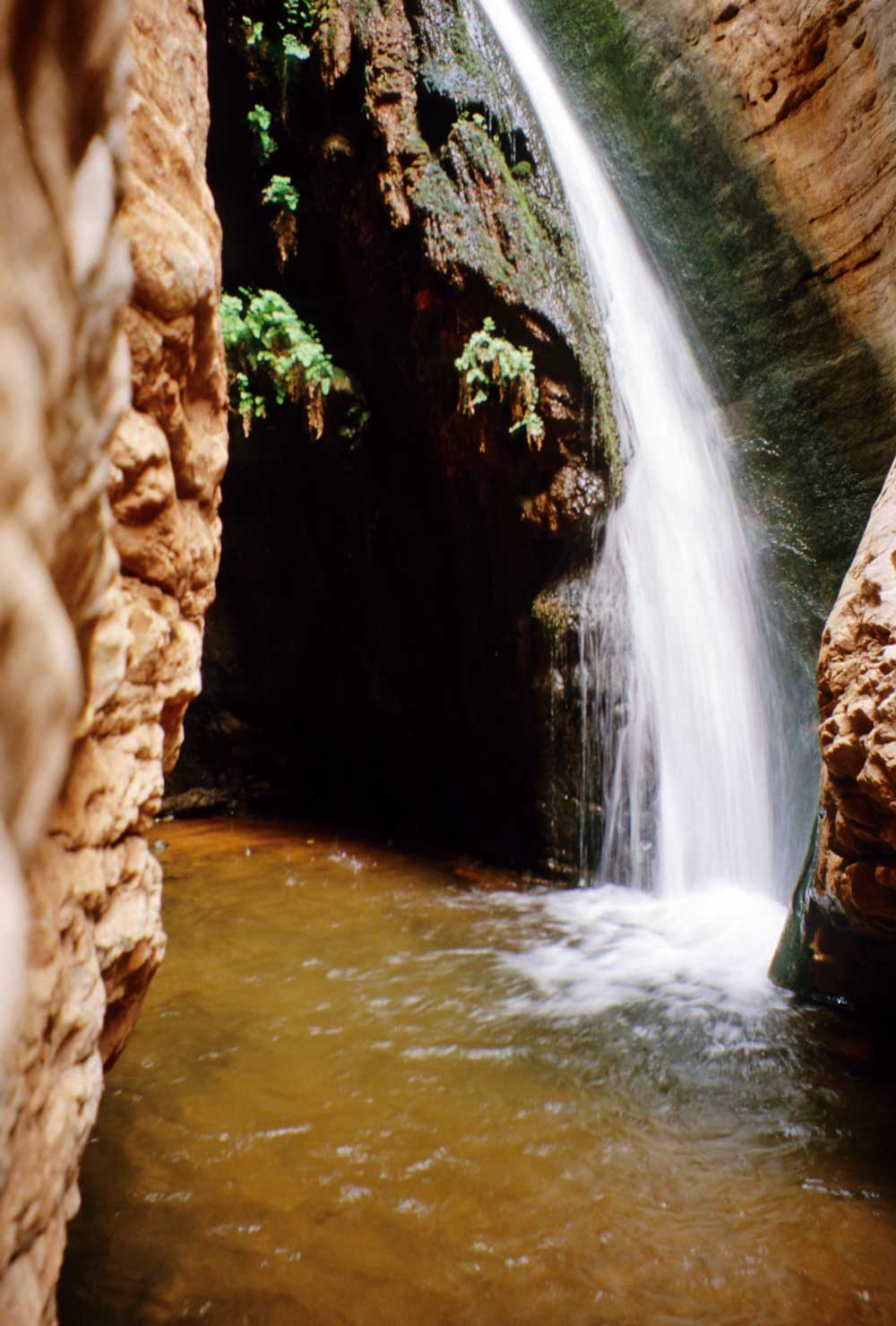
this little waterfall marks the upper end of
the Shinumo Quartz narrows of Stone Creek
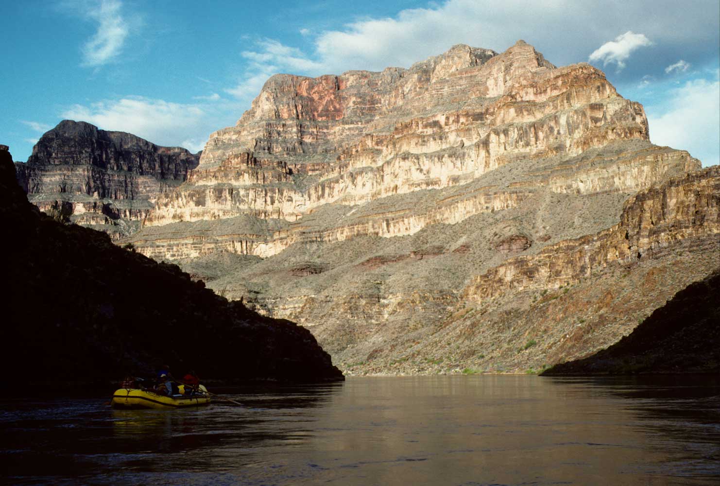
Mile 131.7: Deubendorff Rapid (7-9), Galloway Canyon, and Stone Creek
Galloway Canyon, on the right just above the rapid, and Stone Creek, on the right
just below, invite exploration. Galloway is dry, but Stone Creek features pools,
waterfalls, greenery, flowers, and a magical narrows. Stone Creek makes a great
spot for a layover day. The whole walk up offers pretty scenery, so just tramp as
far as the spirit moves you. Look for a bypass trail on your right around the first
high waterfall about one mile up; more climbing in another mile will take you to
the short narrows that end in a waterfall.
|
|
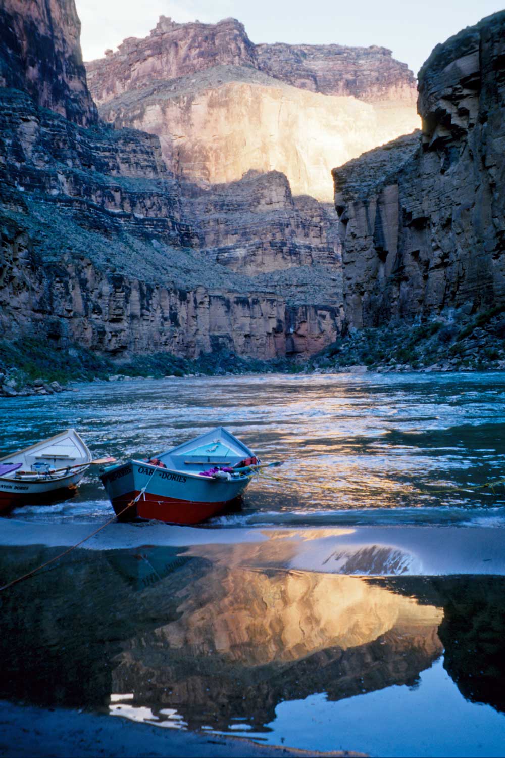
In 1909, Julius Stone earned the distinction of being the first to boat through the Grand Canyon for the fun of it. A president of a gold-dredging company, he had met pioneering boatman Nathaniel Galloway in Glen Canyon and hired him to supervise construction of four wooden, flat-bottomed boats. Galloway had devised both superior river boat designs and a better way of rowing them in the rapids. He found that it made no sense to row blindly into the dangerous rapids when one could simply turn the boat around, face the rapids, and pull upstream to give more time and control to make a safe descent. The new boats, sixteen and a half feet long and four feet wide, featured sealed compartments and light-weight construction. Stone and four companions, including Galloway and helper Seymour Deubendorff, pushed off from Green River, Wyoming, and reached Needles, California, just over two months later. Galloway became the first to make two complete transits of the canyons, and his rowing technique endures today. Deubendorff capsized here, much to his embarrassment at the time.
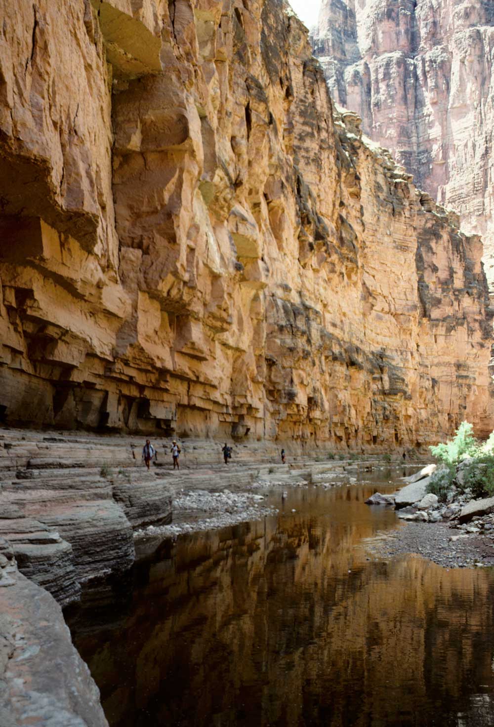
Mile 133.7: Tapeats Rapid (5-8), Tapeats Creek, and Thunder River
Two sets of voluminous springs feed crystal-clear Tapeats Creek, on the
right just above the rapid. Thunder Spring rates as one of the Grand Canyon's top
hiking destinations—you're not likely to be disappointed! Trails from the river
run up both sides of Tapeats Creek. In spring the creek can be too high and swift
to ford easily, when it's best to get off the boats on the downriver side of the
creek. In 2.5 miles you'll reach Thunder River. Yes, the river has the indignity
of both being short and serving as a tributary to a creek!
|
|
A trail climbs steeply half a mile to good vantage points of Thunder Spring as it blasts out of a cave system in the Muav Limestone. Large Fremont cottonwood trees provide shade. In spring or autumn, you can continue 1.5 miles up the trail past Thunder Spring and down into the gently sloping Surprise Valley, renowned for its oven-like heat in summer. A cairn marks the junction of the Thunder River Trail to the North Rim, but continue west 1.5 miles on the Deer Creek Trail that drops to Deer Creek (Dutton) Spring, another cave system spouting a waterfall. You can hike up to the falls for a closer look or take the path that goes higher and behind the falls. The creekside trail winds down one mile past the remarkable Tapeats narrows, then drops (watch out for poison ivy here) to the base of Deer Creek Falls at the river. If it's hot or you can't arrange to be met by boats, Deer Creek makes a great stop on its own.
Mile 134.7: 135 Mile Rapid (5) (Helicopter Eddy)
Mile 135.4: Granite Narrows
The Colorado is constricted to
a width of just 76 feet here, its narrowest in the Grand Canyon.
Mile 136.2: Deer Creek Falls on the right
See the Mile 133.7:
Tapeats Rapid entry above for hiking details on the Deer Creek Trail.
Mile 136.6: Unconformable contact of Precambrian rocks and overlying
Tapeats Sandstone
Tapeats dominates the next 3.5 miles; you'll also
see some Precambrian quartzite and spring-deposited travertine.
Mile 137.7: 137-1/2 Mile (Doris) Rapid (5-7)
Doris, wife
of Norm Nevills, took a swim here after getting washed overboard on one of the early
commercial river trips in 1940.
Mile 139: Fishtail Rapid (5-7)
Fishtail Canyon is on the
right.
Mile 140.1: Conformable contact (no
gap in the geologic record) between the underlying Tapeats Sandstone and Bright
Angel Shale
The river cuts through Bright Angel Shale for the next seven
miles.
|
|
Mile 143.5: Kanab Rapid (3-4) and Kanab Canyon on the right
A major canyon system with many tributaries of its own, Kanab Creek extends
far north into Utah past the town of Kanab to the Paunsaugunt Plateau, 100 miles
from the Grand Canyon. Kanab means "willows" in Paiute. Major Powell ended
his second river expedition here in 1872 and walked out Kanab Canyon. Whispering
Falls makes a good hiking destination; walk up about four miles from the river and
turn right into the first tributary.
|
|
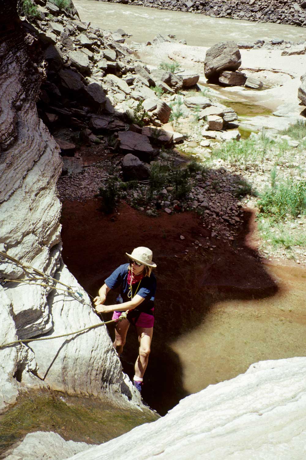
Mile 145.6: Olo Canyon on the left
The overhanging cliff
with a waterfall doesn't look promising for hikers, but some groups send their rock
climber on a bypass just downriver to put in a cable ladder at the pour-off. Two
other steep sections a little farther upstream can be rigged with ropes to aid hikers.
The climb is worthwhile to view the water-sculpted canyon full of pools. Upstream,
the canyon widens a bit and vegetation finds soil to take root. Olo is Havasupai
for "little horse."
Mile 147.1: Conformable contact between the Bright Angel
Shale and overlying Muav Limestone
The river flows through the Muav
for the next 18.6 miles.
Mile 147.9: Matkatamiba Canyon on the left
"Matkat"
presents a beautiful show of rock sculpture and pools similar to those in Olo Canyon.
Agile hikers should be able to make it up Matkat without ropes. As in Olo, you can
hike a long way in, limited mainly by the time you have. It's an Indian family name.
Mile 149.7: Upset Rapid (6-9) and 150 Mile Canyon on the right
The 1923 Birdseye (U.S. Geological Survey) River Expedition had made it
this far when their head boatman, Emery Kolb, performed the group's first flip.
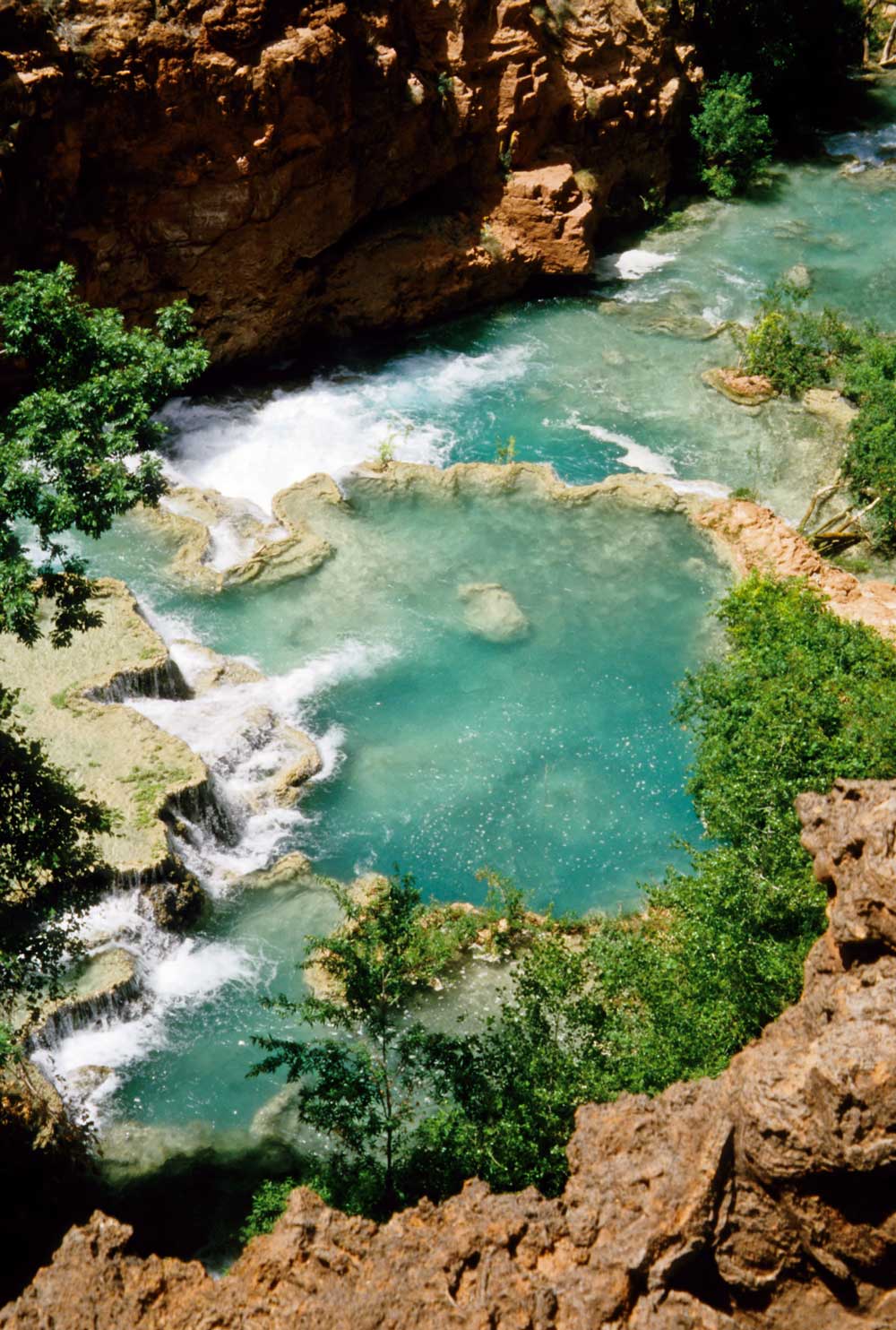
Mile 156.8: Havasu Canyon on the left
The turquoise-blue
waters and Shangri-La reputation of this canyon put it at the top of many river
runners' favorite hikes. Trees, grass, and flowers fill the canyon floor. Havasupai
Indians live in their secluded Supai village about nine miles upcanyon; havasu
means "blue water" and pai means "people." Everyone
wants to visit Havasu Canyon, yet there's no beach to land boats. So boaters have
to tie up in the canyon mouth—an amazingly complex network of interconnected
ropes at times!
|
|
The trail upstream crosses the creek many times, but has little elevation gain to Beaver Falls, four miles away, the most popular destination for river runners. Here you can swim in large pools enclosed by travertine terraces. Fleet-of-foot hikers can continue two more miles to see 196-foot Mooney Falls, the most impressive in Havasu Canyon. No camping is allowed in the lower canyon, so boaters are limited to day trips. For a longer visit, it's best to hike in from the top another time to visit Supai Village and the other waterfalls; see "Havasupai Indian Reservation."
Mile 165.7: Contact of Muav Limestone and the underlying Bright Angel
Shale
The river flows through Bright Angel Shale for the next 10.2 miles.
|
|
Mile 166.5: National Canyon on the left
An easy one-mile
walk, then a rope is needed. There's sometimes a small stream.
Mile 168: Fern Glen Rapid (3) and Fern Glen Canyon on the right
A worthwhile hike of about half a mile takes you to seeps that support expanses
of maidenhair fern.
|
|
|
|
Mile 175.9: Contact of Bright Angel Shale and the underlying Tapeats
The river flows through Tapeats for the next 3.2 miles.
Mile 178: Vulcan's Anvil
The Anvil, a remnant of a lava vent,
rises in the middle of the river. The Anvil marks the beginning of a long stretch
of volcanic features in the Grand Canyon. A series of eruptions took place over
the past million years, burying the countryside under lava and cinders and even
filling the Grand Canyon with massive lava dams. Much of the basaltic lava formed
columnar jointing. The fractures developed as the basalt cooled; cooler spots commonly
formed three radial fracture planes (120 degrees apart) that grew outward and intersected
other fracture planes to create the columnar joints—usually hexagons. The faster
the basalt cooled, the more fractures occurred, so you'll sometimes see cross-sections
of fan-like columns near the surface branching out from larger "trunks"
below.
Toroweap Overlook stands high above on the North Rim with some classic Canyon views. Lava Falls Route connects the river and the Toroweap area, though it's probably best to come by road another time to explore this region; see "Toroweap."
Mile 179.1: Crossing the Toroweap Fault
The downstream side
of the fault has dropped 580 feet, so you go from Tapeats Sandstone to the younger
Muav Limestone, without seeing the intervening Bright Angel Shale; look for the
fault on the left (the right side is covered by lava). From here to the head of
the Lower Granite Gorge at Mile 215.1, you'll be in one of these three formations
or some Precambrian rocks.
|
|
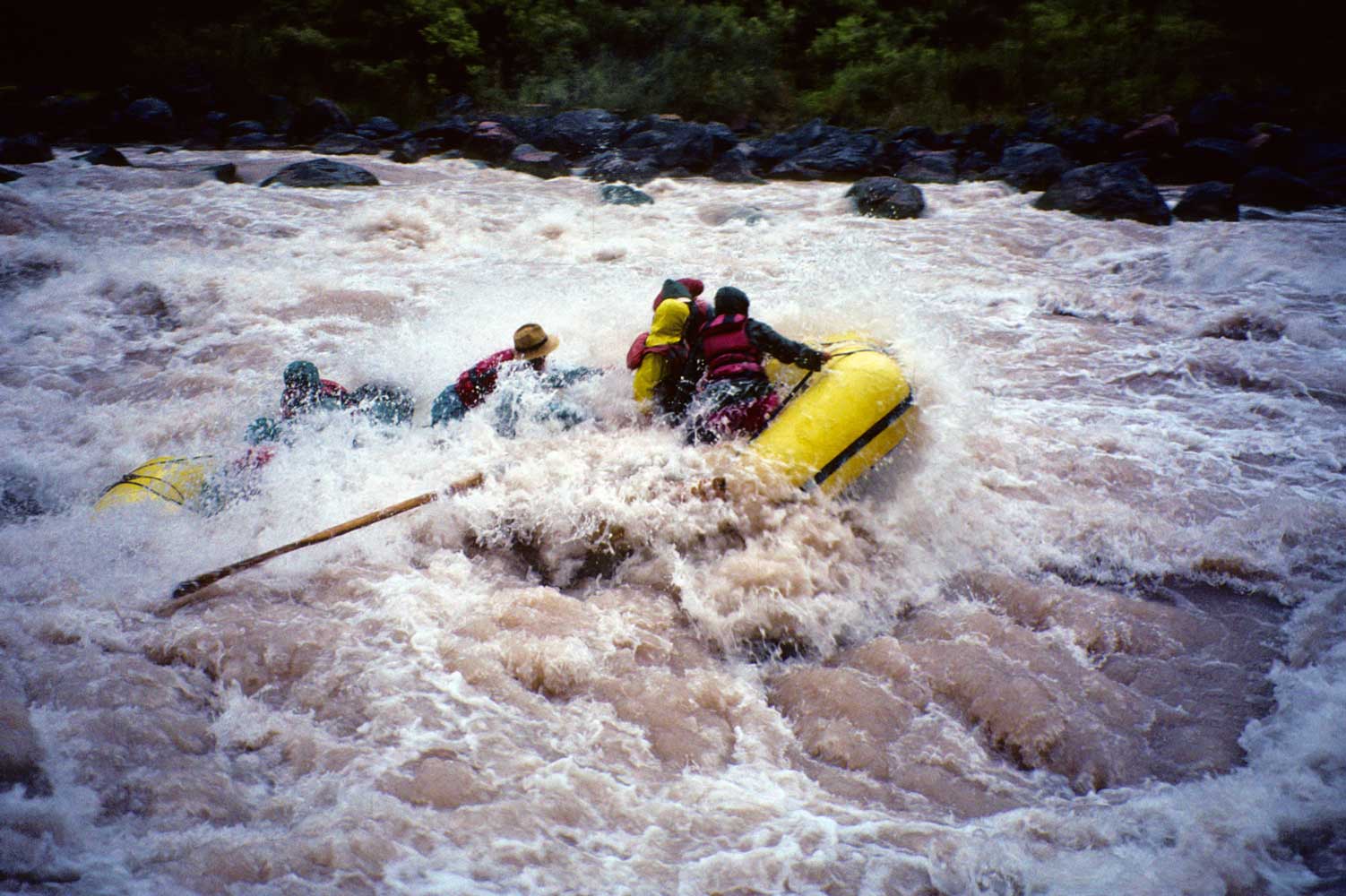
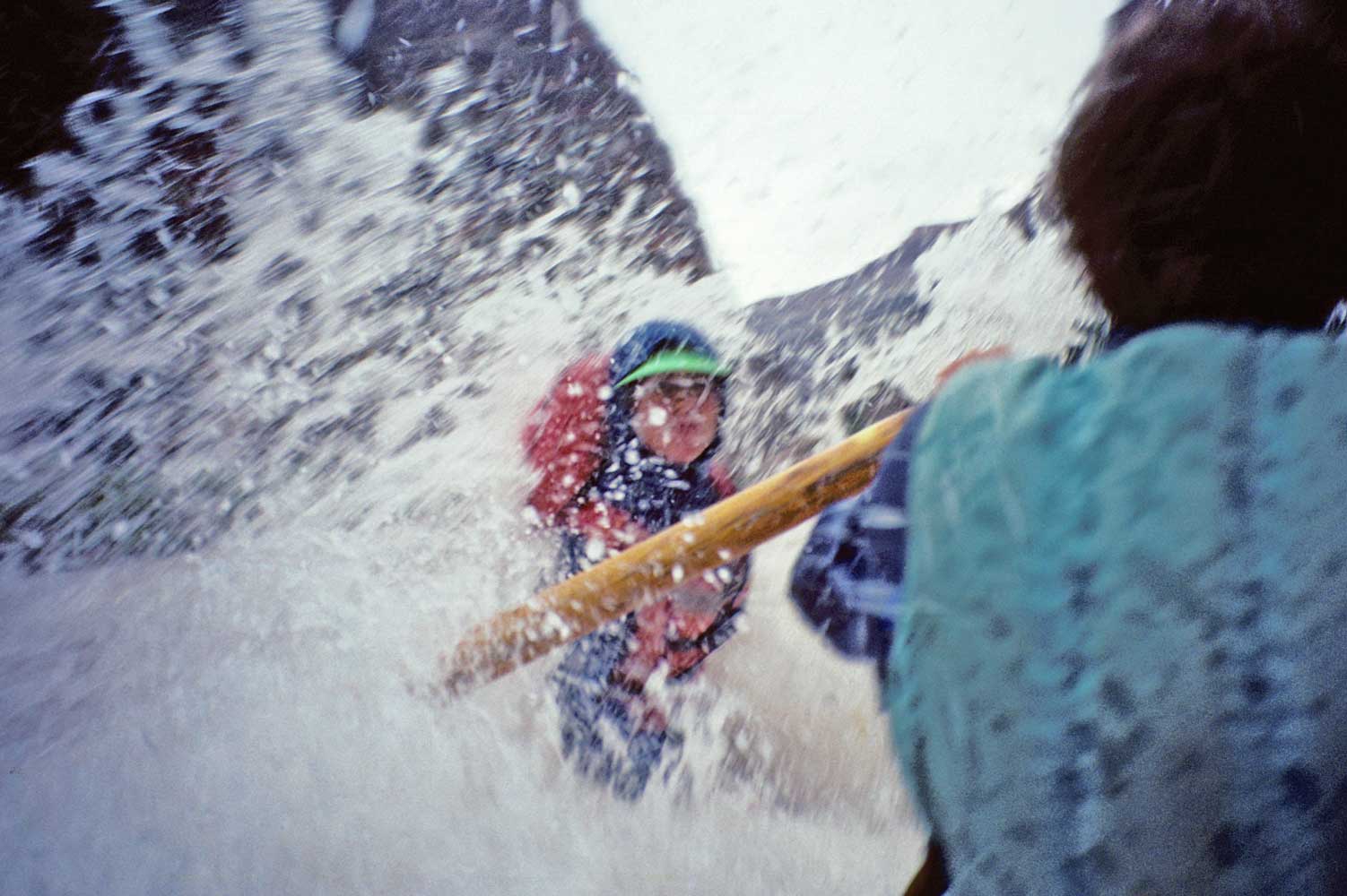
Mile 179.3: Lava Falls Rapid (10)
Boaters may discuss whether
Crystal or Lava Falls is the more difficult, but there's no denying that both are
BIG and deserve lots of respect. After a lengthy scout of the rapid from shore,
you're in the boats and into the wild waves for an exhilarating ride.
|
|
Mile 183: Old river channel filled with lava on the right.
Mile 187: Whitmore Wash on the right
When lava filled the
mouth of Whitmore Wash, the stream cut a new channel farther downriver. You can
easily hike about a half mile up this new canyon. Whitmore Trail climbs from river
to rim in only three-quarters of a mile—the shortest access trail within Grand
Canyon National Park—but you're still a very long and bumpy road from the nearest
town. Some river parties do a passenger exchange here, not by trail, but by helicopter
using a pad on Hualapai Indian land across the river. The helicopter goes to the
Bar 10 guest ranch on the North Rim where a day of activities is usually included;
small planes then take guests to or from Las Vegas or other destinations.
Mile 205.5: 205 Mile (Kolb) Rapid (7-8)
205 Mile Creek is
on the left.
Mile 208.5: Granite Park on the left
The large beach makes
an attractive campsite. Nearby canyons invite exploration. The river splits around
a large, low island just downstream.
Mile 212.2: Little Bastard Rapid (1-7)
Mile 214.3: Shady ledges on the right (below 214 Mile Creek)
The lower Canyon can get mighty hot even in spring and autumn. These ledges provide
a shady lunch spot!
Mile 215.1: Entering Lower Granite Gorge
The Tapeats Sandstone
makes an unconformable contact with the underlying Precambrian granite.
Mile 217.4: 217 Mile Rapid (6-7)
217 Mile Canyon is on the
left.
|
|
|
|
Mile 225.6: Diamond Creek Rapid (4) and Diamond Creek on the left
The name comes from the distinctive 3,512-foot peak that you see long before
reaching the creek; the summit is only 400 feet higher in elevation than Lees Ferry!
The left side of the Colorado River belongs to the Hualapai Indians, who maintain
a 21-mile gravel road from here to Peach Springs on old Route 66. If you were to
stay on the Colorado, there's only one day's river running remaining, then a long
stretch of lake to Pearce Ferry, the next road access. Still, this last section
has great beauty, well worth seeing if you can do it. You can also start river trips
here; contact the Hualapai River Runner's office in Peach Springs.
Mile 229: Travertine Rapid (3) and Travertine Canyon on the left
A bit of steep scrambling up some travertine (a rope is handy) will take
you into a large cave-like room with a refreshing waterfall.
Mile 230.6: Travertine Falls on the left
A waterfall near
the river splashes thousands of sparking drops off large travertine deposits.
Mile 230.8: 231 Mile Rapid (4-7)
Mile 232.2: 232 Mile Rapid (4-7)
Mile 233.5: 234 Mile Rapid (4-6)
Mile 235.3: Bridge Canyon Rapid (3-6)
Bridge Canyon with
a spring and a natural bridge is on the left.
Mile 236: Gneiss Canyon Rapid (3-6)
Gneiss Canyon is on the
left.
Mile 237.2: 237 Mile Rapid (3-6)
Mile 239.6: Separation Canyon on the right
On August 28,
1869, during Major Powell's first river expedition, the hardships of the unknown,
the rapids, and dwindling food supplies brought three of the crew to the breaking
point; they decided to hike out here. Rapids roared just downstream, and what lay
beyond, Powell and the men could only guess. When they separated here, each group
assumed the other to be embracing the greater danger. Powell and his remaining party
safely negotiated the last rapids and left the Grand Canyon at noon on the following
day. The three who climbed out never made it home. Powell later personally investigated
and concluded that the men met their deaths at the hands of Shivwits Indians.
Today there's not much more than riffles where rapids once terrified Powell's men. You're on Lake Mead now, though the Colorado still provides a current and the Canyon still reveals magnificent views. Most groups start motoring out or arrange to be met by motorboats somewhere below Separation, even if they've been rowing so far.
|
|
Mile 259.3: End of the Lower Granite Gorge
Exposures of Tapeats
Sandstone and Bright Angel Shale appear at lake level, though they're likely to
be covered by silt. In pre-dam days, intermittent exposures of Precambrian rocks
reportedly extended all the way to the end of the Grand Canyon.
Mile 266.3: Bat Cave high on the right and Guano Point high on the left
U.S. Guano sank a lot of money to mine a deposit of bat guano (dung used as fertilizer)
from a cave during the late 1950s. Cables suspended from the towers once carried
the guano from Bat Cave on the north side across the Canyon to Guano Point on the
Hualapai Plateau. The Park Service discourages visits to the cave because of disturbances
to the bats. You can visit Guano Point by road or air for spectacular views and
a close look at one of the towers; see "Grand Canyon
West."
Mile 277.7: Grand Wash Fault and End of the Grand Canyon
The Canyon abruptly ends at Grand Wash Fault because rock layers on the west side
have dropped several thousand feet—the Colorado never had a chance to carve
a canyon in them. You're now on the vast expanse of water in Lake Mead National
Recreation Area.
Mile 280: Pearce Ferry
Takeout and the road home.