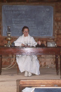
 costumed
guide at Pioneer Living History Village, north of Phoenix. The building comes from
Gordon Canyon on the Mogollon Rim (30 miles east of Payson) where it was used as
a school from ca. 1880-1922.
costumed
guide at Pioneer Living History Village, north of Phoenix. The building comes from
Gordon Canyon on the Mogollon Rim (30 miles east of Payson) where it was used as
a school from ca. 1880-1922.
costumed
guide at Pioneer Living History Village, north of Phoenix. The building comes from
Gordon Canyon on the Mogollon Rim (30 miles east of Payson) where it was used as
a school from ca. 1880-1922.
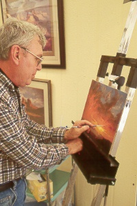 Douglas
Miley of Prescott at the Scottsdale Celebration of Fine Art
Douglas
Miley of Prescott at the Scottsdale Celebration of Fine Art
 F-16
pilots talk about their experiences and planes during Luke Day at Luke Air Force
Base, west of Phoenix
F-16
pilots talk about their experiences and planes during Luke Day at Luke Air Force
Base, west of Phoenix
 tubing
down the lower Salt River
tubing
down the lower Salt River
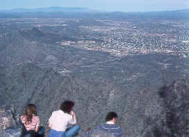 atop
Piestewa Peak in the Valley of the Sun, looking to the north
atop
Piestewa Peak in the Valley of the Sun, looking to the north
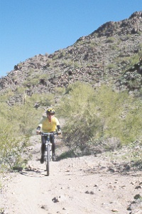 riding
in Estrella Mountain Regional Park, southwest of Phoenix
riding
in Estrella Mountain Regional Park, southwest of Phoenix
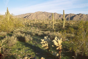 sunrise
view of White Tank Mountain from Ironwood Trail; White Tank Mountain Regional Park,
west of Phoenix
sunrise
view of White Tank Mountain from Ironwood Trail; White Tank Mountain Regional Park,
west of Phoenix
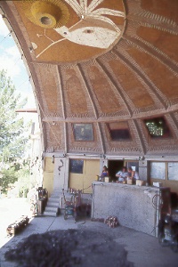 the
foundry at Arcosanti
the
foundry at Arcosanti
The unique experiment of visionary Italian architect Paolo Soleri slowly rises in the high-desert country off I-17 between Flagstaff and Phoenix. Here Soleri and his apprentices seek to correct many of the world's urban problems through revolutionary architecture. He calls his joining of architecture and ecology "arcology." A former student of Frank Lloyd Wright, Soleri has designed Arcosanti to make the best use of energy and land while providing a human-scale environment for its residents. The town will grow vertically, leaving surrounding land in its natural state, by using pedestrian walkways and elevators instead of the sprawl and freeways found in most urban areas. Arcosanti's strangely shaped buildings make efficient use of the sun's energy. The south-facing apses, for example, allow winter sunlight to enter for warmth yet shade the interior during summer. Greenhouses will provide both food and heating, while using only a fraction of the water normally needed for agriculture. You can also visit on the web at www.arcosanti.org. Arcosanti lies 34 miles southeast of Prescott and 65 miles north of Phoenix. It's easy to reach from I-17; take Cordes Junction Exit 262A, then follow signs 2.5 miles on a dirt road.
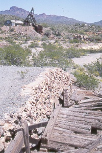 Vulture
Mine, southwest of Wickenburg
Vulture
Mine, southwest of Wickenburg
Ruins of the Vulture Mine and the adjacent ghost town of Vulture City stand remarkably well preserved. They present a rare opportunity to visit a historic mine that has been neither reconstructed nor destroyed. Mining took place at the site from the time of Henry Wickenburg's discovery in 1863 until wartime priorities in 1942 shut the mine down. Gold and silver still lie in underground veins and may be mined again.
You can walk the self-guided, quarter-mile loop past the assay office, glory
hole, headframe and main shaft (more than 2,000 feet deep), blacksmith shop, ball
mill, power plant, apartment houses, mess hall, and other structures. Be sure to
stay on the marked trail—some areas and buildings are dangerous to enter—and
wear good shoes; tel. 602/859-2743. Goldpanning costs extra, but you're sure to
leave with a bit of gold. A book and video sold here have more information on Vulture
Mine. From Wickenburg, head west 2.5 miles on Wickenburg Way, then turn south 12
miles on paved Vulture Mine Road; the mine is on your right.
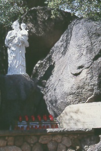 Shrine
of St. Joseph, north of Wickenburg
Shrine
of St. Joseph, north of Wickenburg
A short trail with steps climbs past statues and plaques depicting the stations
of the cross. Giant granite boulders weathered out of the hillside add to the beauty
of the spot; donations welcome. Turn west one-half mile at the sign in central Yarnell.
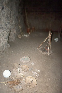 reconstructed
room of the prehistoric Salado Indians at Besh Ba Gowah, in Globe
reconstructed
room of the prehistoric Salado Indians at Besh Ba Gowah, in Globe
Besh Ba Gowah
Archaeologists count 200 rooms at this pueblo,
built and inhabited between A.D. 1225 and 1450, at a time when Salado Indian villages
lined both sides of Pinal Creek. An earlier village of pithouses associated with
the Hohokam stood on this site about A.D. 600-1150. Exposed to both the elements
and humans, Besh Ba Gowah has weathered more than the Tonto National Monument cliff
dwellings, but its extensive foundations and remaining walls testify to its original
size. The name comes from an Apache word meaning "metal camp."
|
|
|
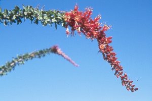
| You can see more than 2,900 different desert plants here in Arizona's oldest (1920s) and largest (323 acres) botanical garden. Exotic species from around the world thrive here alongside the native Sonoran Desert plants. Short trails lead through Sonoran and Chihuahuan desert areas, a cactus garden, riparian natives, palms, pines, eucalyptus, and herb and rose gardens. | |
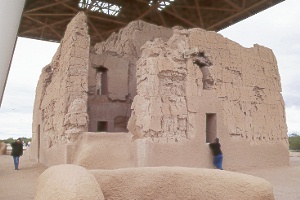 Casa
Grande
Casa
Grande
Arizona's biggest and most perplexing prehistoric building stands a short way off AZ 87, just north of downtown Coolidge. The rectangular structure rises four stories and contains 11 rooms above an earthen platform. An estimated 3,000 tons of mud went into the project, with walls ranging in thickness from 4.5 feet at the base to 1.8 feet near the top.
Archaeologists don't know the purpose of Casa Grande, but some speculate it was used for ceremonies or astronomical observations; certain holes in the walls appear to line up with the sun at the summer solstice and possibly with the moon during selected lunar events. Smaller structures and a wall surround the main building. Hohokam Indians, who had farmed the Gila Valley since about 200-300 B.C., built Casa Grande around A.D. 1350. This is the only structure of its type still standing.
By about 1450, after just a few generations of use, the Hohokam abandoned Casa Grande along with all their other villages. The Jesuit priest Eusebio Kino recorded the site in 1694, giving it the Spanish name for "great house."
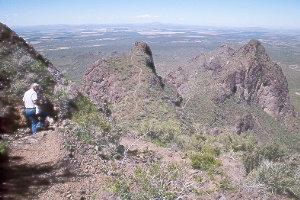 view
from Hunter Trail in Picacho Peak State Park, between Phoenix and Tucson
view
from Hunter Trail in Picacho Peak State Park, between Phoenix and Tucson
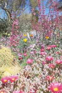
Picacho Peak has served as a landmark for Indians, Spanish explorers,
American frontiersmen, and modern-day motorists. Park visitors enjoy hiking, camping,
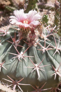
and picnicking in this scenic area. Saguaro and other plants of the Sonoran Desert
thrive on the rocky hillsides. Mexican gold poppies can blanket the hillsides in
spring after a wet winter.
|
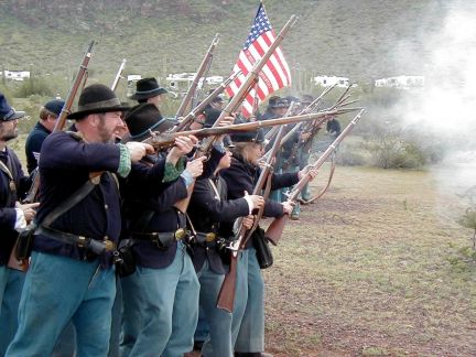
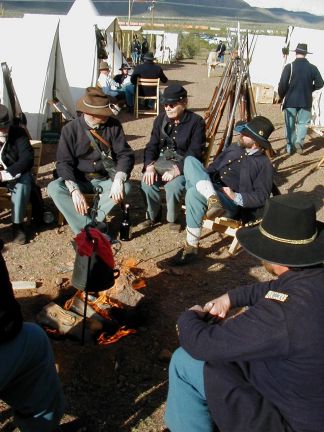
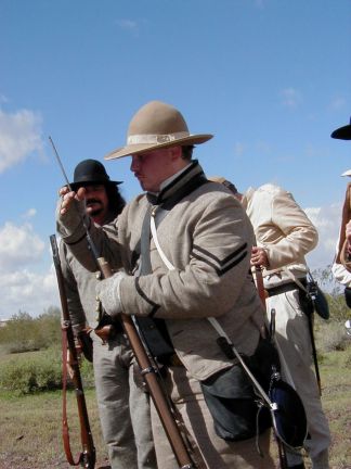
Civil War in the Southwest at Picacho Peak State Park |
|
|
|
|
|
|
|
|
|
On to Photos of Tucson and Southern Arizona
Back to beginning of Photo Gallery
Home