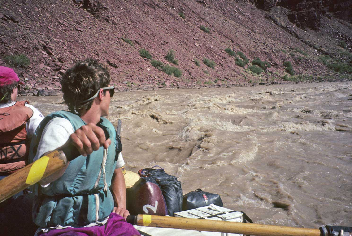
bouncing along in Tanner Rapid
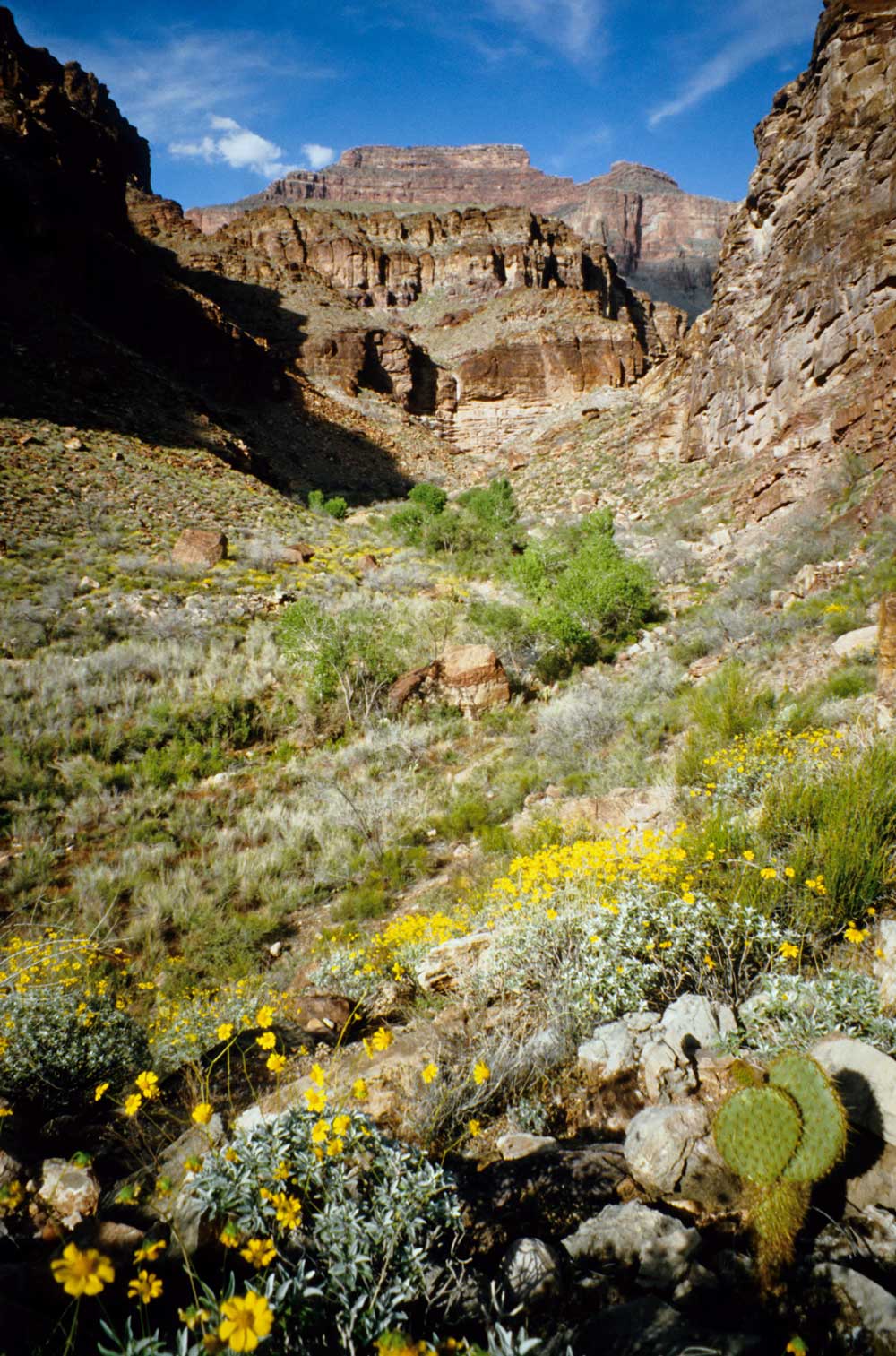
Mile 63.4: The Great Unconformity
About 250 million years
have been lost from the geologic record at this unconformity between the Cambrian
Tapeats Sandstone above and the Precambrian Unkar Group below. The Unkar contains
five formations of about 1,250 to 825 million years ago. From the oldest (lowermost),
they are the Bass Limestone, Hakatai Shale, Shinumo Quartzite, Dox Sandstone, and
the Cardenas Lavas. You'll also hear the term "Grand Canyon Supergroup"
that includes the Unkar Group and three formations of roughly the same time range
that occur in the Colorado River's tributaries but not at river level: Nankoweap
Formation (Nankoweap and Basalt canyons), Chuar Group (Nankoweap, Carbon, and Lava
canyons), and Sixtymile Formation (Nankoweap Butte and upper Sixtymile Canyon).
Faults have tilted these formations and caused large offsets between one side of
the Canyon and the other.
Mile 64.7: Carbon Creek on the right
For a look at the complex
geology in this part of the Canyon, you can hike up Carbon Creek, cut south over
a pass, then descend Lava Canyon to the river, where you've arranged to be picked
up. The pass has especially fine views of the Unkar Group and lava flows. On the
way down Lava Canyon, look for a trail to the left that bypasses a pour-off.
Mile 65.6: Lava Canyon (Chuar) Rapid (3-5)
Lava Canyon is
on the right, Palisades Creek on the left. A park naturalist found a moonshine still
in Lava Canyon in 1928, but you'd be safer to carry your own liquid refreshment
on hikes here.
|
|
Mile 68.5: Tanner Canyon on the left
Hikers descend from
the South Rim on the Tanner Trail to a beach beside the small Tanner Rapid. The
Beamer Trail goes upstream to the Little Colorado. The Escalante Route winds downstream
to connect with the Tonto and New Hance (Red Canyon) trails.
Mile 71: Cardenas Creek on the left
You can scramble south
up the ridge for a wonderful panorama of the Canyon and a look at a stone structure
left by ancestral pueblo people, which may have been a watchtower. Spanish explorer
Garcia Lopez de Cardenas arrived on the South Rim in 1540 as the first white man
to see the Grand Canyon; his group tried but failed to reach the river.
Mile 72.5: Unkar Rapid (6-7)
Ancestral pueblo people once
farmed the Unkar delta on the right. You can stop to look at foundations of their
pueblo village.
Mile 75.5: Nevills Rapid (6)
Norm Nevills led the first commercial
river trip through the Grand Canyon in 1938.
Mile 76.8: Hance Rapid (8-10)
Rock gardens in the river present
a real challenge, especially to the hard-shelled dories. Red Canyon on the left
is the start of the long Tonto Trail that heads downstream and the Hance (Red Canyon)
Trail that climbs up to the South Rim. John Hance arrived at the Grand Canyon in
1883, built the first lodge on the South Rim two years later, made trails, did some
mining, guided tourists, and entertained his guests with amazing yarns, such as
the time the Canyon filled with clouds and he just strapped on his snowshoes and
walked across. On stretches where trails parallel the river, it's amazing how much
difference in time it takes between foot and boat travel. A lazy day on the river
with just an oar-powered boat can equal several hard days on the trail!
Mile 77: Upper Granite Gorge
Another Great Unconformity
marks the boundary between the Unkar Group and rocks even more ancient, perhaps
1.7 billion years old in the Lower Precambrian Period. Time and unimaginable extremes
of pressure and heat have folded, twisted, and crystallized these rocks, which probably
once lay underneath a mountain range. Despite the gorge's name, you'll find mostly
gneiss (a coarse-grained metamorphic rock with bands of visibly different minerals)
and schist (a dark, easily split, metamorphic rock with closely spaced bands of
mica). Pink pegmatite (a coarse-grained igneous rock) was injected into these rocks.
You'll see milky quartz too. The Upper Granite Gorge extends about 48 miles downstream.
The Canyon's character changes dramatically as the dark walls close in, constrict
the river, and speed up the water's flow.
Mile 78.7: Sockdolager Rapid (8-9)
Major Powell's second
expedition used a slang word meaning "knockout blow" for this one. Powell's
men had no option to portage their frail craft here, so they ran the rapid with
the loud roar of the waves reverberating off the Canyon walls.
Mile 81.5: Grapevine Rapid (8)
Grapevine Creek comes in from
the left, Vishnu Creek from the right.
Many of the rock "temples" and
canyons below the North Rim have names of Eastern gods and philosophers. The Hindu
god Vishnu preserves the world. Geologist Clarence Dutton started the "heroic
nomenclature" for Grand Canyon features.
Mile 83.5: 83 Mile Rapid (3-5)
Mile 84: Clear Creek Canyon on the right
You wouldn't think
such a small stream and canyon could drain a large area of the North Rim. It's worth
making the short hike of about half a mile up to a small waterfall. You could also
climb around the waterfall and continue far upstream. Clear Creek Trail connects
the creek with the North Kaibab Trail near Phantom Ranch.
Mile 84.6: Zoroaster Rapid (5-8)
Zoroaster Creek on the right
descends from the south side of Zoroaster Temple. Around 700 BC, the Persian philosopher
Zoroaster founded what became a major religion of that region.
Mile 85: 85 Mile Rapid (2-6)
|
|
|
|
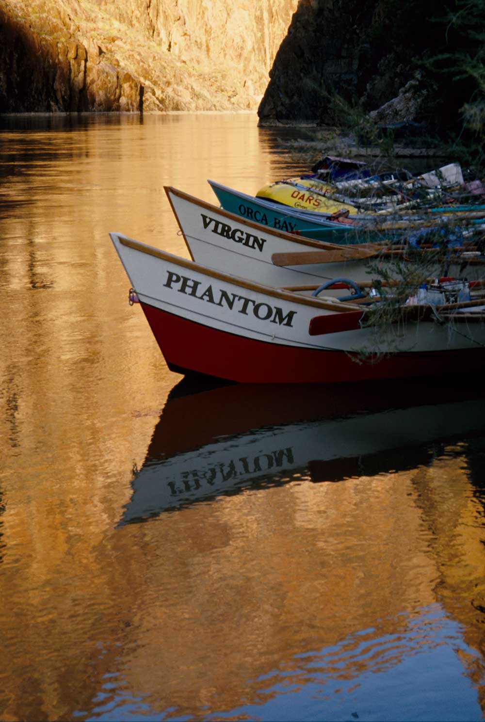
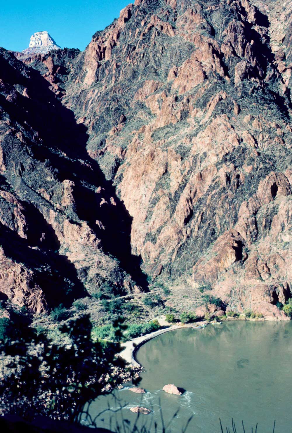
Mile 87.5: Kaibab Bridge
The South Kaibab Trail from the
South Rim crosses the river here on its way to Phantom Ranch after a very scenic
descent of 6.8 miles to Bright Angel Camp via Cedar Ridge. The bridge warns you
that a touch of civilization lies just ahead. River trips put in at the beach on
the right past the bridge to exchange passengers if some are leaving or joining
at this point. You can wander over to Phantom Ranch to use a telephone, mail your
postcards via mule train, buy snacks or souvenirs at the store, or marvel at a flush
toilet that you haven't seen for days!
If you have time for a hike, try part of the North Kaibab or climb the Clear Creek Trail for views. Or leave the crowds and head up Phantom Creek to its lush greenery and small waterfalls; walk about one mile up the North Kaibab Trail until you see this creek on the other side of Bright Angel Creek, which you'll have to ford.
Mile 87.8: Bright Angel Rapid (4) and Bright Angel Bridge
Major Powell named the swift and clear-flowing Bright Angel Creek to honor the forces
of good, after naming the muddy Dirty Devil River upstream in Utah. Much of the
Bright Angel's flow comes from Roaring Springs, which blast out of caves in the
Redwall Limestone below the North Rim. Hikers can reach the North Rim on the 14.2-mile
North Kaibab Trail.
Mile 89: Pipe Springs Rapid (4-5)
The Bright Angel Trail
turns up Pipe Creek Canyon on its well-graded, 7.8-mile-long ascent to the South
Rim.
Mile 90.2: Horn Creek Rapid (8-10)
Horn Creek comes in on
the left. Two boulders near mid-stream give the rapid its name.
|
|
Mile 93.5: Granite Rapid (9)
Monument Creek on the left offers
an easy walk up to the Tonto Trail.
Mile 95: Hermit Rapid (8-9)
Hermit Creek on the left also
provides a scenic walk up the Tonto Trail. Louis Boucher, the Hermit, mined copper
and guided tourists in the area during his stay from 1891 to 1912. He wore a white
beard, rode a white mule, and told only"white lies."
Mile 96.8: Boucher Rapid (3-5)
Boucher Creek on the left
is an easy walk to the Tonto and Boucher Trails.
|
|
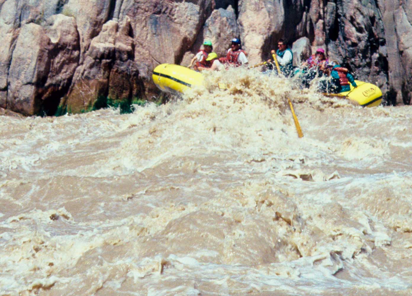
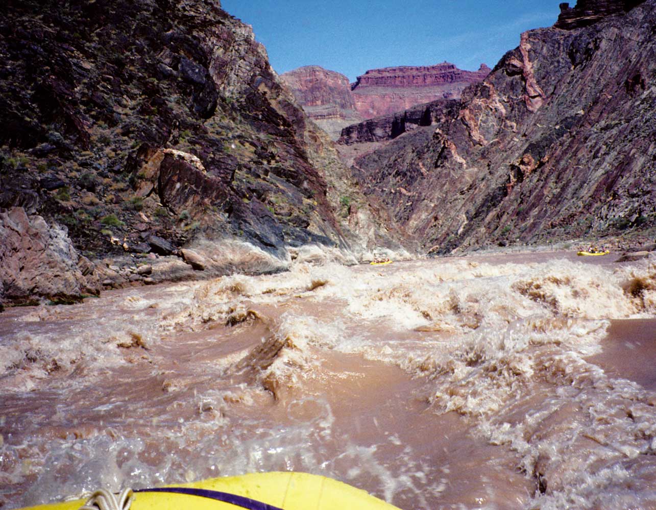
Mile 98.2: Crystal Rapid (10)
This fierce rapid has weakened
the knees of many a river-runner scouting it from the shore. Places in the Grand
Canyon may stay nearly unchanged for more than a century, only to be turned topsy-turvy
by a single storm. That happened here in 1966 when a massive flood tore through
Crystal Creek (on the right), washing many huge boulders into the Colorado and forcing
the river into the left wall. Now boaters must pick out a route that stays clear
of the rocks, the wall, and giant, boat-flipping holes. If you're camping near here,
enjoy a pleasant stroll up the relatively open canyon of Crystal Creek.
Mile 99.2: Tuna Creek Rapid (6)
Mile 101.3: Sapphire Rapid (7)
One of a series of rapids
here called "The Jewels." Sapphire Canyon is on the left.
Mile 102: Turquoise Rapid (3-6)
Turquoise Canyon is on the
left.
Mile 103.9: 104 Mile Rapid (5-7)
Mile 104.6: Ruby Rapid (6-7)
Ruby Canyon is on the left.
Mile 106: Serpentine Rapid (6-8)
Serpentine Canyon is on
the left. Serpentine (an ornamental stone) and asbestos (sought out by Hance, Bass,
and other prospectors) occur in the Canyon where molten volcanic rock subjected
the Bass Limestone to intense heat.
Mile 107.8: Bass Rapid (3-6)
Bass Canyon on the left and
the South Bass Trail, just upstream of the rapid, provide access to the Tonto Trail
and South Rim. William Bass arrived in the 1880s, did some prospecting, raised a
family, and ran a tourist operation until he left the area in 1923. He built tourist
camps and constructed trails to both South and North Rims. Boats, and in 1908 a
cableway with a cage big enough for horses, connected his trails. The Park Service
cut the cable in 1968, so there's no crossing today. A metal boat, the Ross
Wheeler, lies on the left bank just above the rapid where it was abandoned
about 1914.
|
|
Mile 108.2: Beach and trailhead for Bass's Camp on the right
From this popular campsite, a trail climbs high over a ridge (blazing with yellow
brittlebush in spring), drops to Shinumo Creek, then winds upstream to Bass's Camp.
You'll discover relics of his camp and small farm along the swift, sparkling creek.
Cottonwood trees shade the banks. Be sure to carry lots of water and a sun hat for
this hike of two miles each way. The North Bass Trail continues another 12 miles
upcanyon to the pine-forested North Rim.
Mile 108.7: Shinumo Rapid (4)
Boats can pull in at lower
Shinumo Creek on the right so that you can take a short walk to a pool and waterfall.
The waterfall blocks hikers from continuing upstream to Bass's Camp.
Mile 112.2: Waltenberg Rapid (6-9)
John Waltenberg worked
with William Bass in developing copper and asbestos mines in the area during the
early 20th century.
Mile 112.6: 112-1/2 Mile Rapid (1-6)
Mile 113.1: Rancid Tuna Rapid (6)
One can only assume that
this rapid was named by an early boating expedition that discovered the terrible
truth about its food situation here.
Mile 114.4: Garnet Canyon on the left
The Tonto Trail ends
its 92-mile meandering at this canyon.
Mile 116.5: Elves Chasm on the left
Royal Arch Creek creates
this beauty spot with a waterfall, greenery and flowers, and extensive travertine
deposits.
Mile 116.9: Stephen Aisle
This straight section of Canyon
runs about two miles. The Upper Granite Gorge ends in this section at a fault where
the river cuts into Tapeats Sandstone. From here until the start of the Middle Granite
Gorge at Mile 126.6, you'll be seeing stretches of Tapeats Sandstone, Precambrian
gneiss, and Bright Angel Shale.
Mile 119.8: Salt deposits on the right
Look on the right
for alcoves filled with salty stalactites, stalagmites, and columns. It's possible
to stop here or walk back from the Blacktail Canyon camp 0.3 mile farther.
Mile 120.1: Blacktail Canyon on the right and Conquistador Aisle
Blacktail Canyon offers a short hike into Tapeats Sandstone narrows. Conquistador
Aisle, another two-mile straight section of canyon, lies downstream.
Mile 121.7: 122 Mile Rapid (4-6); Bright Angel Shale
Mile 122.8: Forster Rapid (6)
Forster Canyon is on the left.
Mile 125: Fossil Rapid (6-7)
Fossil Canyon is on the left.
Mile 126.6: Middle Granite Gorge; salt deposits on the left
Schist and quartzite make up most of the low walls of this narrow, 3.9-mile
gorge. The older rocks here have been cut by sheet-like dikes of igneous pegmatite
(coarse-grained rock) and amphibolite (dark rock composed mostly of the mineral
hornblende).
Mile 129: Specter Rapid (5-8)
Specter Chasm is on the left.
Mile 130.5: Bedrock Rapid (8) and Unkar Group
Bedrock Canyon
and the "Doll's House" are on the right. Middle Granite Gorge ends just
below, where the river cuts into the Unkar Group. Bass Limestone with its igneous
intrusions dominates the next five miles.