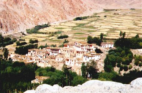
It's harvest time at this village above Leh.
Cycling into very thin air with Bill and Bessie Too
Leh, Ladakh, India
16 September 2002
Last year in Pakistan, Bessie Too and I had cycled up the Shyok River to the verdant village of Khaplu, an easy ride from the confluence with the Indus River. Here in Ladakh there was a major obstacle to reaching the Shyok River—the Ladakh Range. The only way over was via Khardung La at an astonishing 5602 meters (18,380 feet)! With only half the oxygen of sea level, was it possible to pedal a loaded bicycle across such heights? And at the advanced age of 50 years? I decided to find out.
Fortified with a cheese-tomato omelet and corn flake breakfast, I turned north and started a 39-km (25-mile) climb to the highest heights I've ever tried to cycle. Such elevations really only belong to mountaineers and yaks. The kilometers slowly ticked by, and Leh started to recede into the depths below. I passed the last village, and wound up into barren brown hills. After a while, I was no longer looking up at the Zanskar Range across the Indus Valley, but directly across at them. Police at the South Pullu checkpost made sure I had the required permit to cross over to the Nubra and Shyok Valleys. I kept spinning away in my "granny" first gear, though I was sure that any Ladakhi granny could easily have passed me on foot!
I was stopping more and more to catch my breath, a seemingly impossible task at times. I was inhaling and exhaling two times a second, but that wasn't always enough. The sun coursed across the sky as I slowly pedaled ever higher. Finally, at sunset, only three kilometers remained. I was going to make it, I thought. Intense cold soon had me put on a down jacket, mitts, and helmet liner, but they seemed to have little effect. Then with darkness descending, I rolled through the pass. There was no time for celebration or photos—little light remained and I had to get down the other side. To stay overnight at the pass would have invited altitude sickness. Into the cold mists of the north side I rolled, past snowy hillsides and across frozen puddles. The 14 km (9 miles) of descent seemed to take forever—and the lights of North Pullu remained tantalizingly distant. Tired and cold, I finally arrived at the military post. A tea stall fixed up some hot soup and I set up my little tent nearby.
Frost and a few snowflakes greeted me in the morning. The remaining descent was cold, but by mid-day I reached the Shyok River, actually a bit lower than Leh at about 3100 meters (11,000 feet). As I rolled downstream, the valley broadened and the river braided across its vast expanse. Sand dunes rose from the riverbed. I was disappointed not to see any of the Bactrian (2-humped) camels said to be native to the area. (The Shyok and Nubra Valleys were once part of a trade route between Ladakh and Central Asia.)
I stayed in Hunder Village at the Snow Leopard Guest House, with its flower-filled garden, good food, and a real HOT shower. Soldiers at a nearby check post wouldn't let me go any farther. Hopefully peace will come to Kashmir some day and the river route will open again to travelers headed down the Shyok to Pakistan.
The next morning I headed back up the Shyok River, stopping at Diskit Gompa on the way. Fearsome guardian figures, so powerful that most were partially shrouded only to be uncovered at festival times filled one of the monastery's rooms . I turned left up the Nubra Valley to Panamik, famed for its hot springs. The springs didn't disappoint—I had a great hot shower at the end of the day!
The guidebook indicated that Panamik was as far as travelers could go, but I sneakily cycled farther up the valley to Sasoma, at a great bend in the river. Soldiers didn't object to my being there, but said that I couldn't go much farther. Far upstream I could see the white of the vast Siachen Glacier, where troops of India and Pakistan have fought under extremely harsh conditions.
Returning to Leh took two days, and on the way I camped in the rain near Khardung Village. Luckily the mists partially cleared the next day and the return ride was easier than the first crossing. I could enjoy the pass this time, take photos, and marvel at the great clouds that passed by just overhead. The downhill to Leh was fantastic!
It's harvest time at this village above Leh.
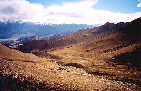
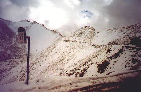
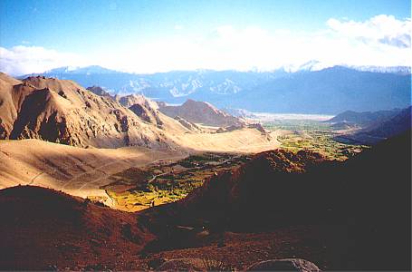
I had to show my permit at North Pullu (lower center).
The town of Leh lies at
the left edge of the photo in the patch of dark green.
Snowy peaks of the Zanskar
Range stand in the distance.
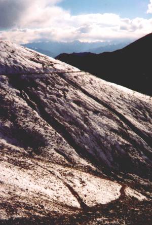
Looking back toward the Zanskar Range
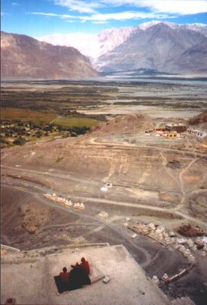
Monks enjoy the panorama of Shyok Valley from a rooftop at Diskit Gompa.
Coming back up the Kardung La, and only one more kilometer more to the top.
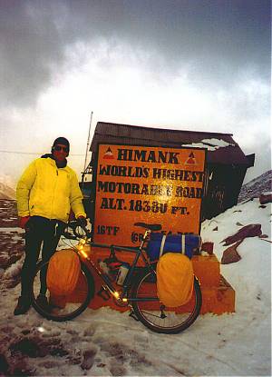
High enough
(The actual elevation is likely a few hundred meters (1,000
feet) lower than what the Indians claim.)
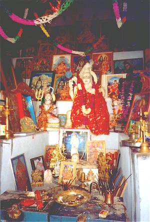
Shiva has the place of honor in this shrine at Kardung La.
Yes, Bihari laborers live and toil in the frozen world of Khardung La.
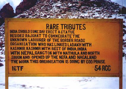
The Indian
government tries to keep the road over the pass open year-round
to support the
large military presence in the Nubra and Shyok Valleys.
Here we are swooping down toward Leh in the distance.