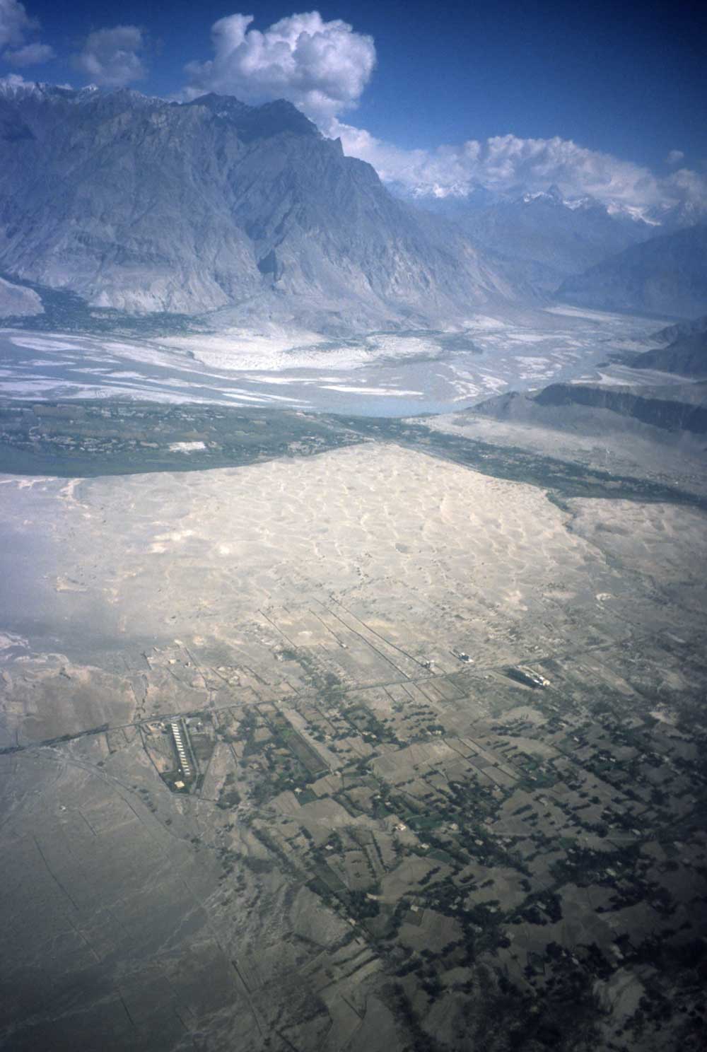
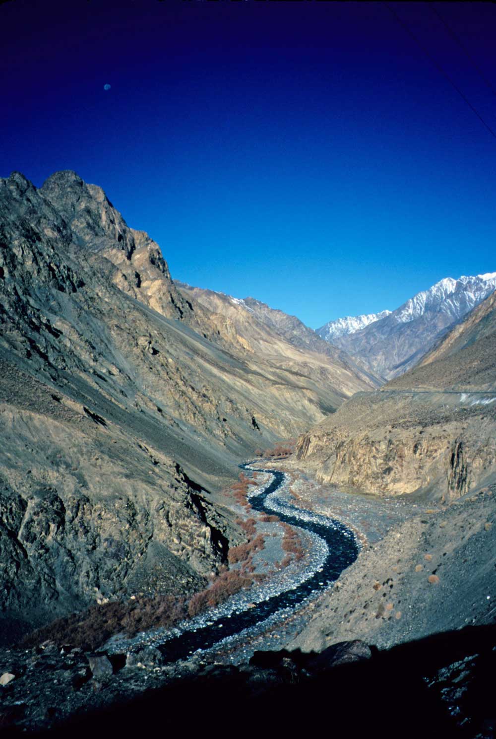
The Indus River valley near Skardu; taken on the flight from Islamabad
Welcome to a long and wonderful ride between the icy peaks of the Karakoram Mountains of northern Pakistan and the lush jungles of southern India! Here are the e-mails sent along the way along with some photos.
Subject: Bill and Bessie Too the Bicycle head for the hills
Date: Tue, 18
Sep 2001 11:57:07
Bangkok, Thailand
Applause broke out as China Airlines Flight 003 touched down on the rain-soaked runway at Taipei in Taiwan. It was the airline’s first flight out of SFO in nearly a week. I was very happy to see last week finally come to an end and to be on my way.
At the beginning of this month I was exhausted from finishing up the last details of three guidebooks, all due out around year’s end—a new illustrated guide to Arizona in the National Geographic Traveler series, an 8th edition of Moon Handbooks: Arizona, and the 2nd edition of Moon Handbooks: Grand Canyon. I waited until the last minute to get airline tickets. Although I had searched the fancy Internet sites, in the end it was an old-fashioned travel agent at the other end of a telephone who had by far the best fare, just $617 roundtrip to Bangkok. The ticket (for the wee hours of the 16th) was issued on Sept. 10th, but everything fell apart the next day. My original plan of cycling up through Chitral in northwestern Pakistan no longer seemed such a good idea, as it was just a stone’s throw from Afghanistan. I also didn’t have a clue as to when overseas flights would resume from SFO.
In the predawn hours of Saturday morning, China Airlines’ website announced that flights were resuming that day. I still didn’t know where I was going and didn’t even pack a guidebook. The first flight went right on schedule. (Great food too.) At Taipei’s typhoon-wracked airport, I watched cancellations and delays affect my next flight. Then, after hanging around 12 hours, our 747 took off on the 3+ hour trip to Bangkok. Today I tackled the question of where to go next. Bangkok feels like a steam bath now—no place for a tour. After a call to the Pakistani embassy here and a reassuring e-mail from a Pakistani friend, I decided to head for northern Pakistan. A PIA flight should have me in Rawalpindi later tonight. I’ll try to get on a domestic flight to Skardu in northeastern Pakistan tomorrow morning. That will put me in the mountains at a comfortable elevation of a little over 7,000 feet. Then I’ll start training for one of the world’s toughest and spectacular bicycle rides—the lofty Karakoram Highway to Kashgar in China! Skardu is south of K2, the world’s 2nd highest peak; trekking is said to be fantastic below this mountain, though that will have to wait for another trip. My goal will be to follow the Karakoram Highway over the Khunjerab Pass (around 15,000 feet) then descend to Kashgar. There, I will return overland through northern Pakistan and exit to India. If Pakistan is having problems, I’ll head for India by air.
Now off to the Karakoram Mountains.
Subject: Bill and Bessie Too in the mountains
Date: Fri, 28 Sep 2001 08:18:15
Gilgit, Pakistan
Lightning flashed across the sky—one bolt leaving a chain of fireballs—as I took a taxi to the Bangkok airport for the flight to Islamabad in Pakistan. The plane took off ok about 1 a.m., though I noted that journalists onboard outnumbered tourists.
On arrival at Islamabad, I met a couple from Belgium who also were planning to ride to China. We got on the morning 737 flight to Skardu. The plane climbed over higher and higher ridges and west of Nanga Parbat, the great ice mountain at the west end of the Himalaya. Then the plane had to descend the great distance to Skardu in the Indus Valley at 8,000 feet. I realized why the flight was “weather dependent”!
The next morning we cycled up a tough jeep road to a pretty mountain lake, then detoured to a Buddha figure carved on a cliff, a reminder of a civilization here around 800 A.D. Cycling was tough on rough road in the thin air, but it was time to get in shape.
Skardu was hosting a week-long “Silk Route Festival” with the polo matches as the big excitement for locals. A huge police contingent kept the audience participation from getting too out of hand. The game looked very difficult to play—like hitting a golf ball from a bouncing horseback. Craftspeople at booths demonstrated spinning and weaving, done by both men and women, but only women made the fine embroidery. Agricultural exhibits showed the fine fruit and vegetables grown in the region. Apples are especially tasty here.
The Belgian couple headed on to Gilgit, but I cycled up the Indus and Shyok Rivers to Khaplu, a verdant town spread across an alluvial fan beneath high, barren mountains. Icy jagged peaks of the Karakoram Range rose across the Shyok Valley. I spent a day walking to a small peak and visiting a former palace. People in town and along the way were extremely friendly. Women were very shy and girls would giggle, so I mostly met just the men and boys. The men have a very gently handshake, a sort of touching hands.
The ride down the Indus passed Skardu, then entered a narrow canyon. I had the good fortune of being on the side of the road nearest the drop of hundreds of feet into the raging river. Much of the road was carved out of cliffs—very exciting cycling. High snow peaks rose above the warm valley.
The awesome trip to Gilgit took 4 days from Khaplu. Now I’m resting and trying to use Hotmail, no small task in this isolated town. There’s also a festival here now, which I’ll drop by this afternoon.
Tomorrow it’s north to the famously beautiful Hunza region, then up, up, up the Khunjerab Pass to China and the central Asian town of Kashgar.
(Click photos for a larger view.)
The Indus River valley near Skardu; taken on the flight from Islamabad
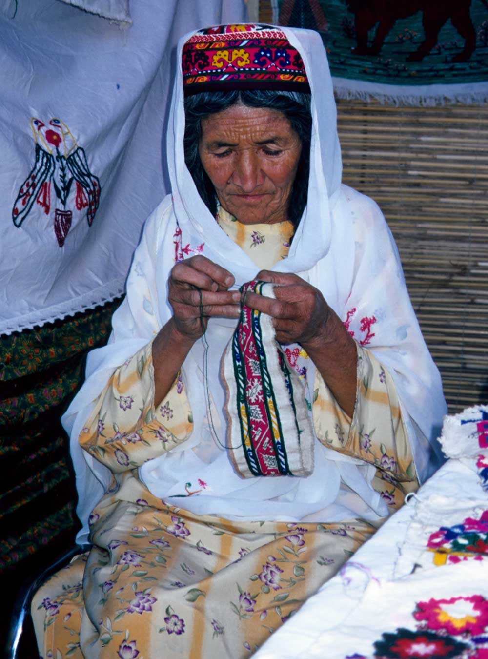
A lady from Hunza doing embroidery at the Silk Route Festival in Skardu
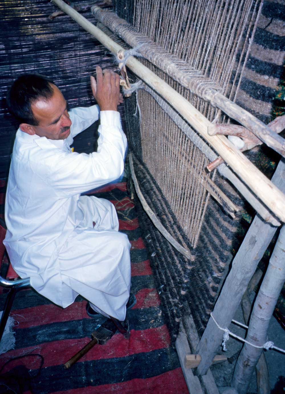
Weaving a rug at the Silk Route Festival in Skardu
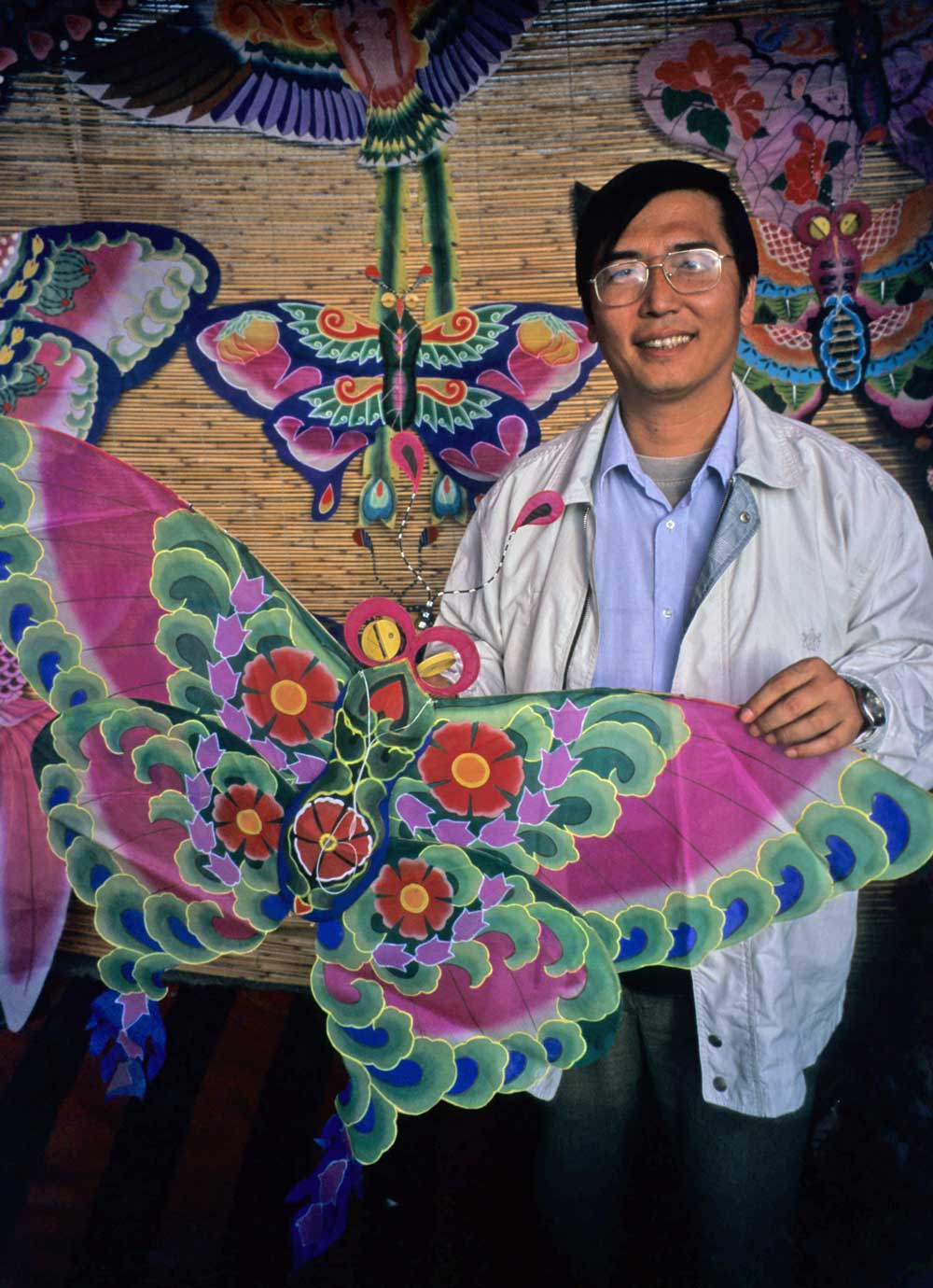
Kite maker from China at the Silk Route Festival in Skardu
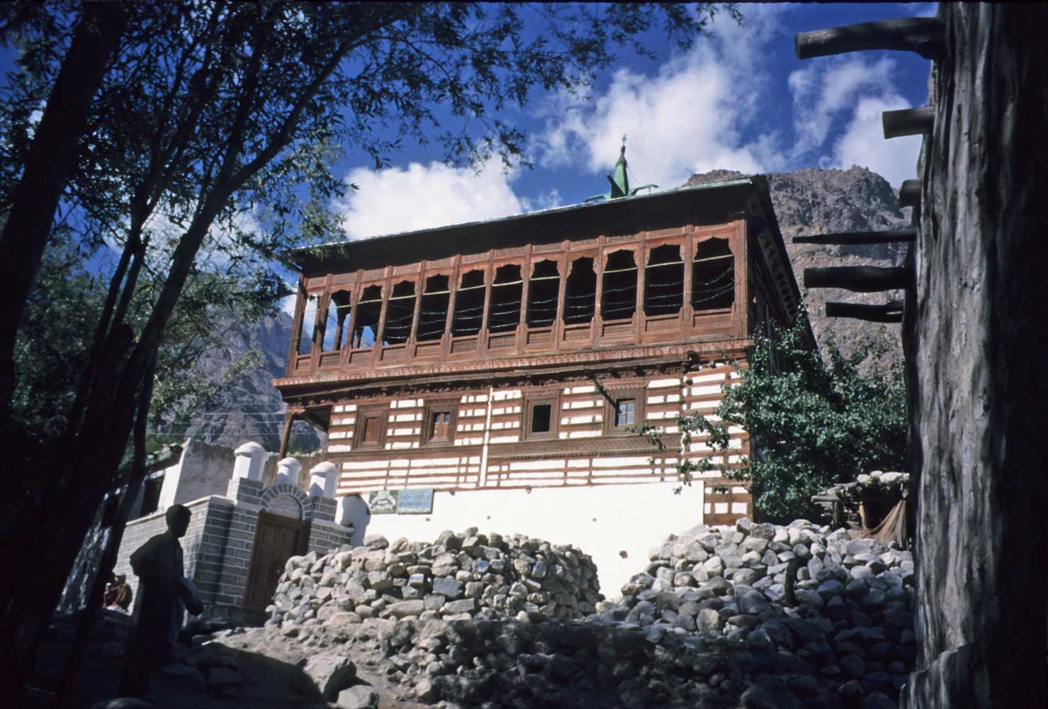
This mosque in Khaplu may have once been a Tibetan temple.
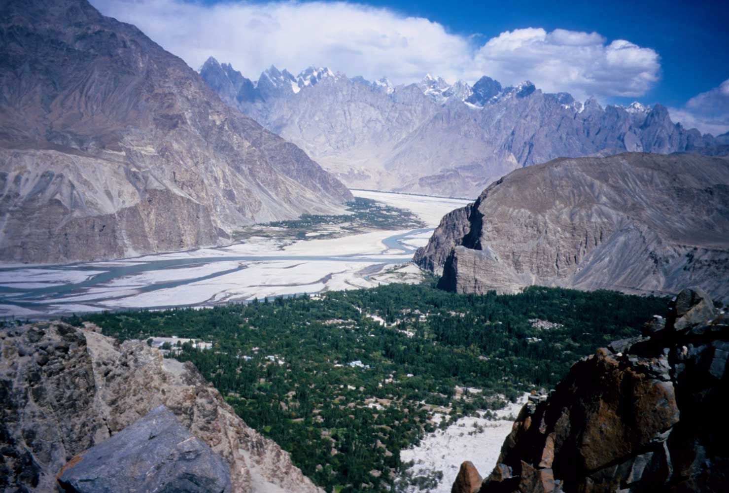
This view looks across the greenery of Khaplu to the Shyok River and jagged peaks
of the Karakoram.
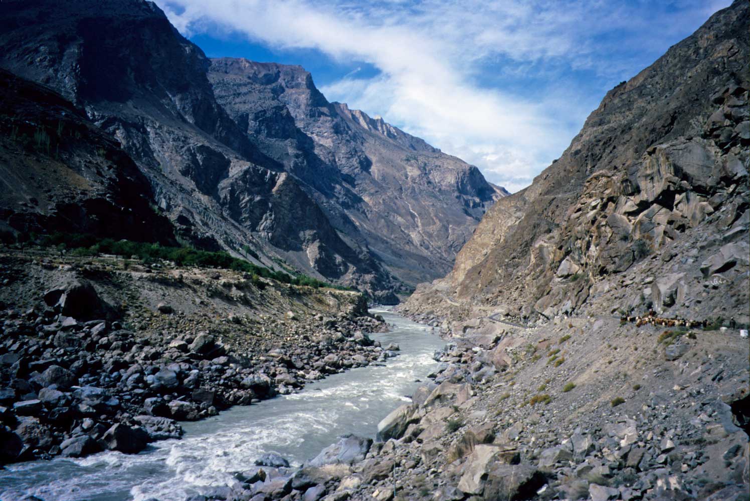
The Indus River, and the road carved out of the cliffs on the right, plunge into
the deep gorge below Skardu.
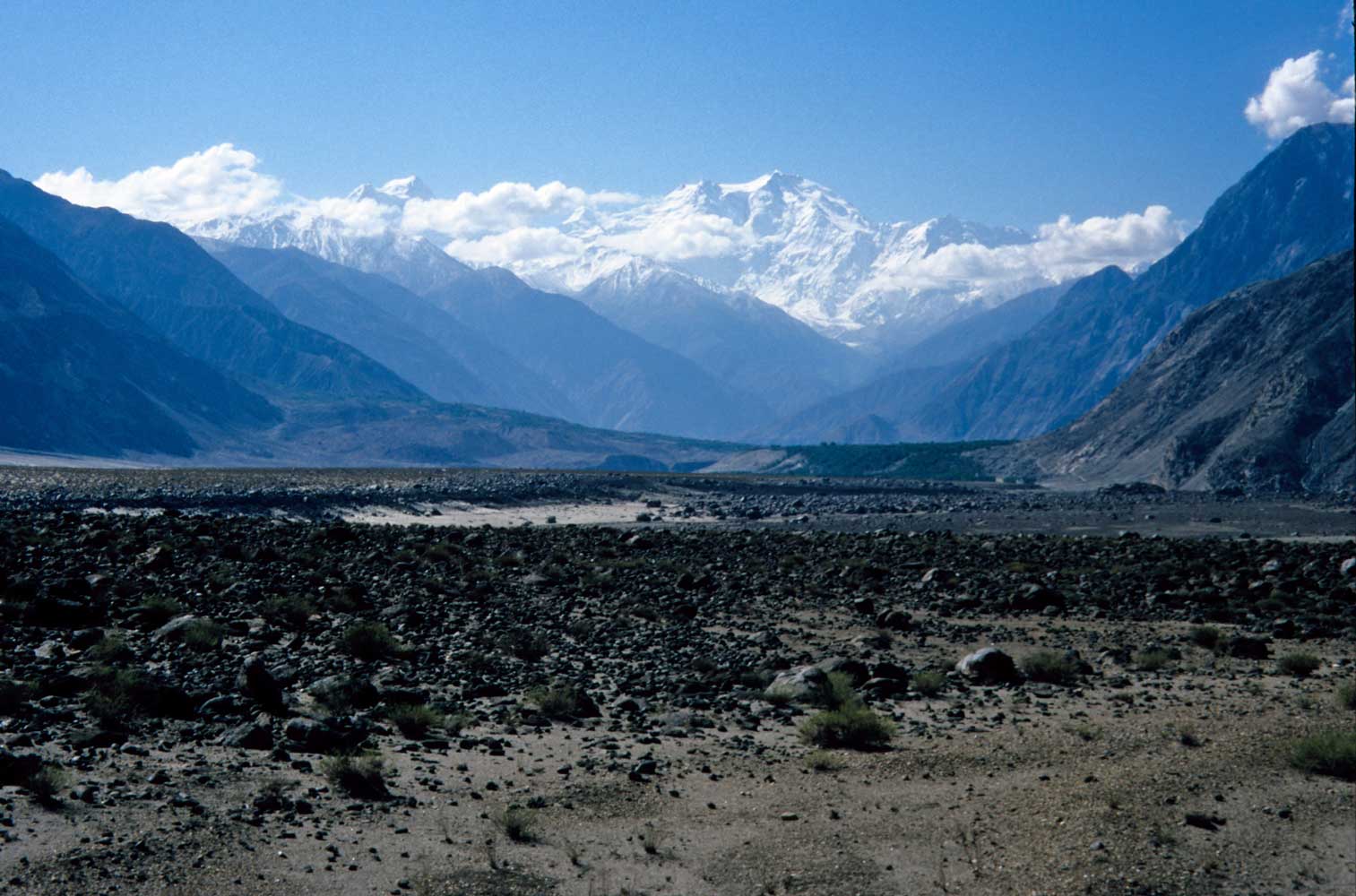
Nanga Parbat �naked-mountain,� stands as the ninth-highest mountain in the world at 8,126
meters (26,660 ft).
I leave the Indus River here
and turn north to Gilgit, several hours away.
Subject: High in the Karakoram Mountains
Date: Sat, 13 Oct 2001 07:00:28
Islamabad Airport, Pakistan
The giant vulture circled overhead repeatedly as I slowwwly cycled up the Khunjerab Pass. Was it hungry or just curious? Eventually it flew off to join its mate. By late afternoon the guardhouses of the pass finally came into view. This was the crossing to China at the world’s highest international border crossing and the highest paved road pass—a breathtaking 15,000-foot plus. Snow lay in the shadows, and yaks grazed high above on the grassy hillsides. The Chinese guard waved a hello, but the Chinese government had stopped cyclists from riding on the Chinese side a couple months ago; I don’t the reason. At the pass, I turned around into what was now a freezing wind and a cold setting sun for the ride partway down the pass back into the Pakistani side. I camped that night next to a Khunjerab Security Forces checkpost—definitely a hardship post. Wolves howled that night. The next morning I whizzed down through the crystalline air to Sost, the highest town. Buses from there crossed to China, but I didn’t wish to get sick from a smoke-laden bus interior.
I’d already cycled up the Hunza River Valley to Sost and it was so spectacular that I retraced the route back to Gilgit. The gardens and orchards of the Hunza area were said to inspire stories of a Shangri La. Farmers turned barren hillsides into beautiful farms. Besides potatoes and other vegetables, villagers cultivated orchards with such crops as apricots, apples, and walnuts. I laid over some days for walks in the villages and hills to better enjoy the local life and mountain views. Another year I plan to return to the area for some trekking.
Bessie Too the Bicycle and I have had a great tour of the Northern Areas of Pakistan since arriving Sept. 19th. People were extremely friendly, the mountain scenery fantastic, and the weather almost always sunny. Add to all that the bright autumn colors and you have superb bicycle touring! The Pakistanis were well aware of the ‘situation’ in Afghanistan, but I didn’t experience even one bit of anti-Americanism. Nearly all tourists have fled, though, which has been tough for hotels and shops.
I just flew in on a super-scenic flight from Gilgit past Nanga Parbat and other snow peaks. In an hour I fly to Lahore near the Indian border. The next adventure will be a ride in western India! ‘Sorry some of you were worrying, but things have been fine.
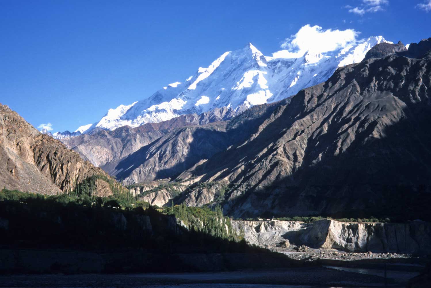
A day's ride north of Gilgit on the Karakoram Highway brought me to the base of
this glistening mountain, Rakaposhi.
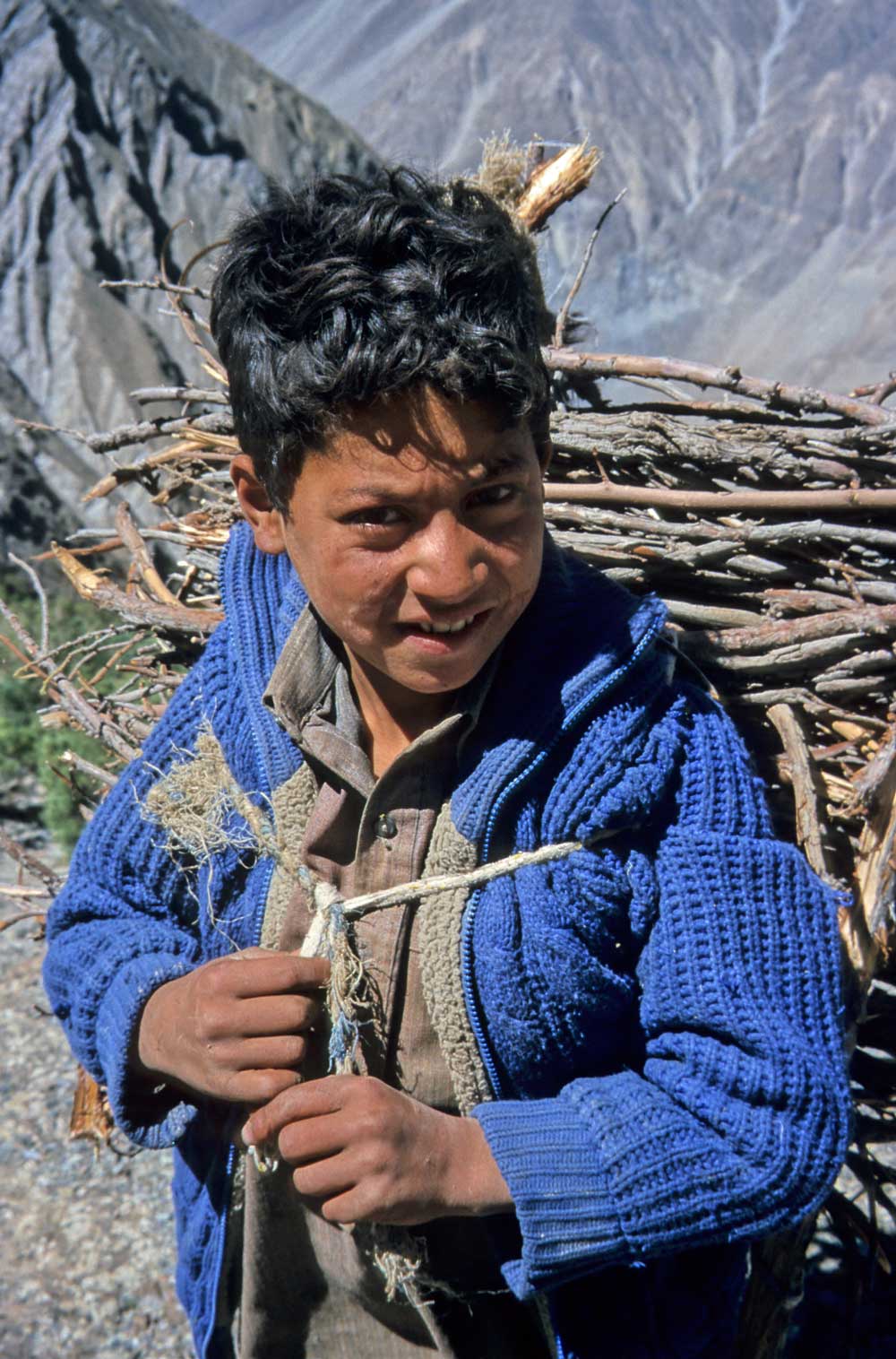
Firewood for the family hearth from the lower slopes of Rakaposhi
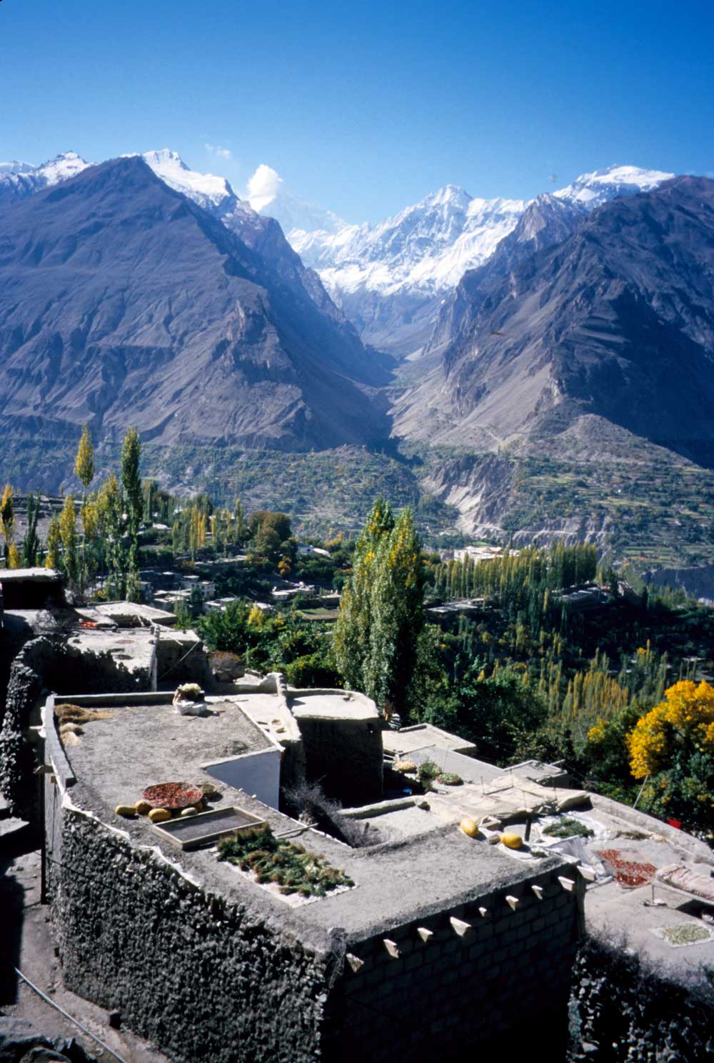
View across the Hunza Valley from Baltit Fort in Karimabad
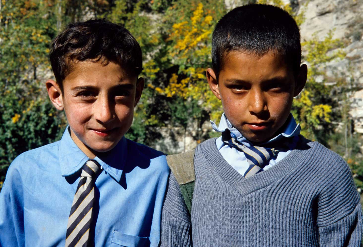
Schoolboys are happy to strike a pose; near Karimabad.
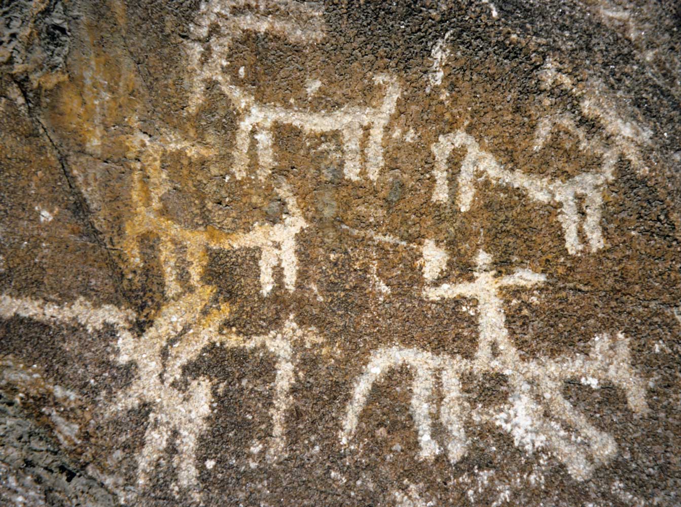
This rock art beside the Karakoram Highway records the passage of travelers since
ancient times.
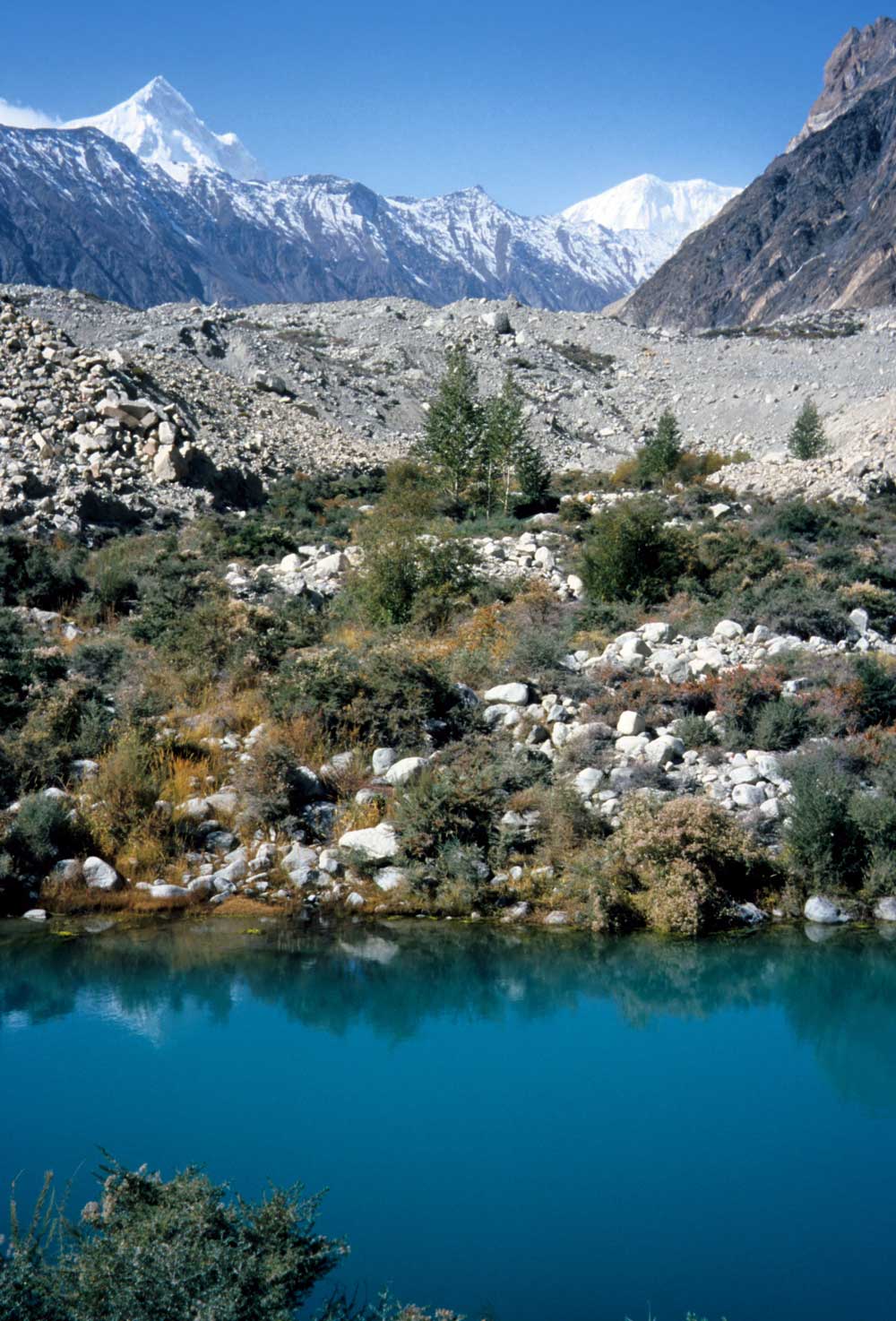
A pool and bare rocks mark the terminus of Batura Glacier.
The ice once devoured
a highway bridge here.
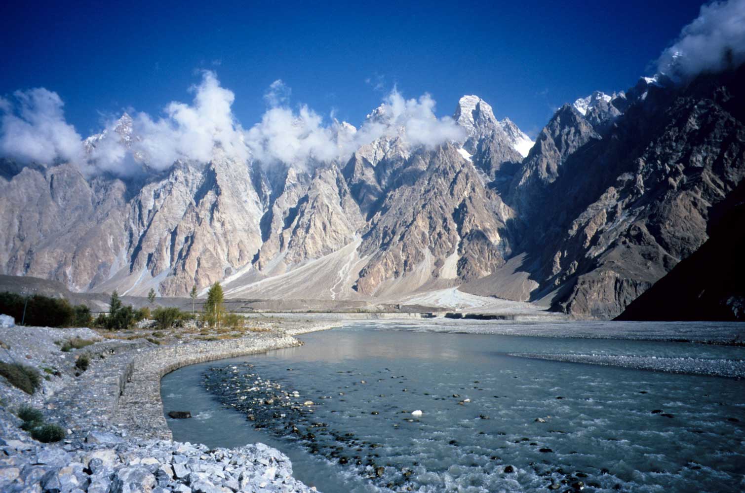
Heading up the Hunza River on the Karakoram Highway. Cycling doesn't get much more
exciting than this!
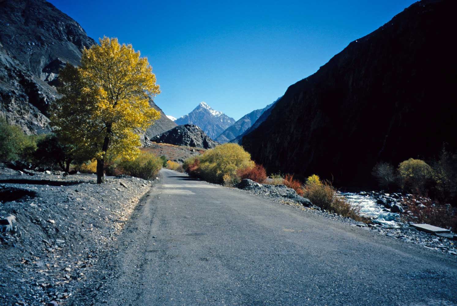
Turning up the Khunjerab River valley with a tailwind, smooth road, autumn colors,
and dazzling blue sky.
Today I'm headed for the Khunjerab Pass.
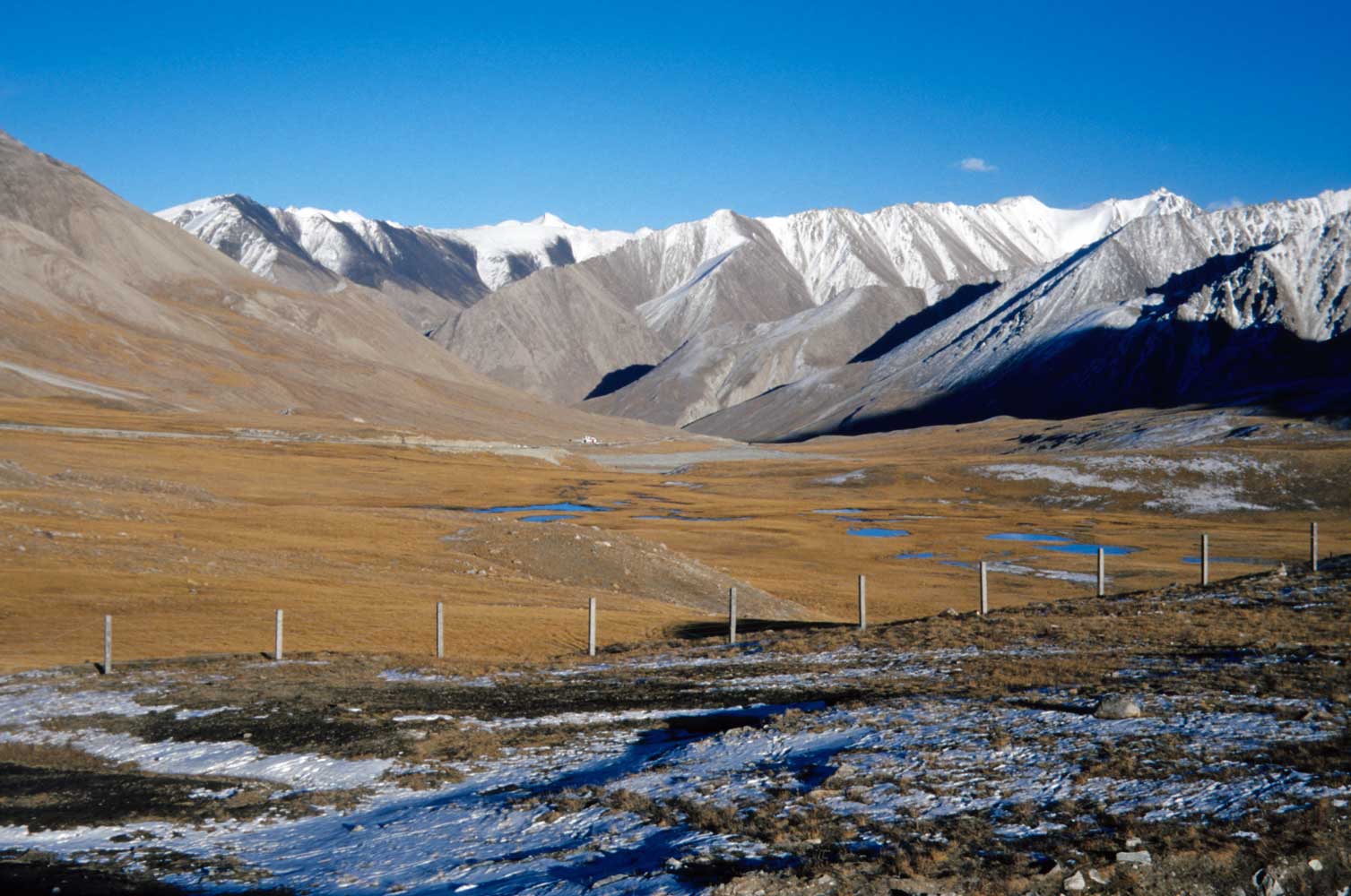
View down the Khunjerab River valley. No villages are this high up, though people
bring their animals to graze.
Made it! This view looks across the border fence into China. Khunjerab Pass (4730
m)
is the highest crossing between two countries. A recent turn in the workings
of Chinese bureaucracy
meant that Bessie Too and I had to turn around here, instead
of continuing the 400km to Kashgar.
Subject: Bill and Bessie Too meet TRAFFIC
Date: Sun, 14 Oct 2001 17:30:41
Amritsar, India
You would have to see the traffic in Lahore, Pakistan, to believe it! Everything with wheels, hooves, or feet crowds the streets and bazaars. The ride into town from Lahore’s airport seemed another world from the lonely mountain roads and deep blue skies experienced in the north. Lahore seems ok for tourists. I even met one, a Frenchman who was enjoying a week seeing the sights in this cultural center of 6 million.
I DO recommend Pakistan as a very good place to visit when the Afghan situation improves. The Northern Areas, especially, offer wonderful travel for cyclists, trekkers, and sightseeing. The main hazard in my experience was thorns—I got about seven flat tires, though most were slow leaks that I fixed in the comfort of my hotel room. The great cycling nemesis—dogs—were almost entirely absent in Pakistan. I saw some near Gilgit and Lahore, but none had any interest in chasing cyclists. Boys can be a hazard, if they reach a critical mass, as they display excessive irrational exuberance at times. Boys DO chase bicycles.
The Press seems to report only BAD news about Muslim countries. When was the last time you read something good about places like Bangladesh or Syria, for example? Yet these and the other Islamic nations I’ve visited have been friendly and interesting places to travel.
Now I’m on two new adventures. I arrived in India today, where I’ll head first to Rajasthan in the west. The other milestone is that I turn 50 today, but I’m not counting the years anymore!